Geoportal is just a map source, and it's brilliant, extremely detailed like os maps. As Phil says stick to grs and you won't go far wrong, normally every junction has a white and red stripe painted on trees or rocks, etc, and a red cross for the wrong track. Hope this helps, and enjoy.bikenav wrote: ↑Thu Feb 03, 2022 5:49 pm Thanks PIF how will we know the limitations ie walking only, I also saw a sign marked equestrian what is the story with that, passed many of these over the years and been tempted but never actually followed one occasionally ridden a trail where they have joined and left but always considered them the hikers domain, the uneducated eh, think there is a similar network in Spain too. The Geoportal site am I right in thinking that is not a route creator just a point creator? The paper IGN series I have experience of, but is it free to download, can it be used as a GPS navigator plateform, phone or GPS unit or is it a view only type resource? I have a GPX file for some of the GR's if anyone require's it (Mr Speed?) this thread is becoming inlightening. Mr Noodles in the meantime as someone who has evolved their navigation probably along a similar path that you are exploring look up talkytoaster not tried it myself but may be of help at a cost, or alternatively as a free substitute for OS maps outside of the UK look up Open Source Maps OSM . As we have kinda hijacked your thread please throw in any more queries I am sure we will all help to try and skin your cat one way or another, Youtube will also prove helpfull if you feel the need.
Possible week in France and ...
-
chunky butt

- Posts: 2036
- Joined: Thu Nov 13, 2014 10:39 pm
- Has thanked: 54 times
- Been thanked: 699 times
Re: Possible week in France and ...
-
Onenoodles
- Posts: 79
- Joined: Sun Mar 28, 2021 6:37 pm
- Location: Worcester
- Has thanked: 1 time
- Been thanked: 53 times
Re: Possible week in France and ...
Thats awsome Phil and thank you ... I have no French language skills at all but I reckon I can still follow those ... cheersPHILinFRANCE wrote: ↑Thu Feb 03, 2022 7:19 am https://www.gr-infos.com/gr-en.htm
all marked with a red and white stripe, some have been only footpaths for a long time but most are passable with a 2CV
-
PHILinFRANCE
- Posts: 6065
- Joined: Wed Aug 24, 2011 5:35 am
- Has thanked: 3467 times
- Been thanked: 1823 times
Re: Possible week in France and ...
@ Bikenav
sign marked equestrian, most are using GRs and VTT routes its just helping riders follow suitable routes for horses
sign marked equestrian, most are using GRs and VTT routes its just helping riders follow suitable routes for horses
I'M HERE FOR A GOOD TIME NOT A LONG TIME
https://www.facebook.com/groups/1806825 ... =bookmarks
https://www.youtube.com/user/PHILinFRANCE1
https://www.facebook.com/groups/1806825 ... =bookmarks
https://www.youtube.com/user/PHILinFRANCE1
-
byewayrider
- Posts: 559
- Joined: Fri Nov 29, 2013 3:45 pm
- Has thanked: 26 times
- Been thanked: 80 times
Re: Possible week in France and ...
The French local communiteis have a big say in gr routes... But always marked up.... A map is useful as a guide but the ign topo is hard to beat in a GPS... The trails change from one valley to next and dept too... The tet is the best source.... Vvt trails are fun on a enduro...
Solo ktm690 euro trail rider
-
bikenav
- Posts: 1277
- Joined: Mon Jan 28, 2013 11:46 pm
- Location: Llanelli
- Has thanked: 1187 times
- Been thanked: 761 times
Re: Possible week in France and ...
What device do you run the IGN topo on? I failed to find a source for it for Garmin, memory map or a phone looks more hopefull.byewayrider wrote: ↑Thu Feb 03, 2022 8:20 pm The French local communiteis have a big say in gr routes... But always marked up.... A map is useful as a guide but the ign topo is hard to beat in a GPS... The trails change from one valley to next and dept too... The tet is the best source.... Vvt trails are fun on a enduro...
-
byewayrider
- Posts: 559
- Joined: Fri Nov 29, 2013 3:45 pm
- Has thanked: 26 times
- Been thanked: 80 times
Re: Possible week in France and ...
The garmin topo maps are all based on local European mapping.. Ign in France and Spain too.... There are a few versions about... They show marked gr in red if I remember correctly and gr number and the chemin are black dotted lines.... Vvt are marked on signs or arrows on tarmac.... Legally speaking vvt are for mountain bikes but they cross chemin routes so most are okay... Wouldn't want to do them on a big bike though... Be very carefull at public hols and summer as the gr routes are full of walkers.... Safety etc...
The French Codover site is great too...
The French Codover site is great too...
Solo ktm690 euro trail rider
-
PHILinFRANCE
- Posts: 6065
- Joined: Wed Aug 24, 2011 5:35 am
- Has thanked: 3467 times
- Been thanked: 1823 times
Re: Possible week in France and ...
¨^^^^^^^^^^what he said
TOPO France is a must
The GRs can get tight
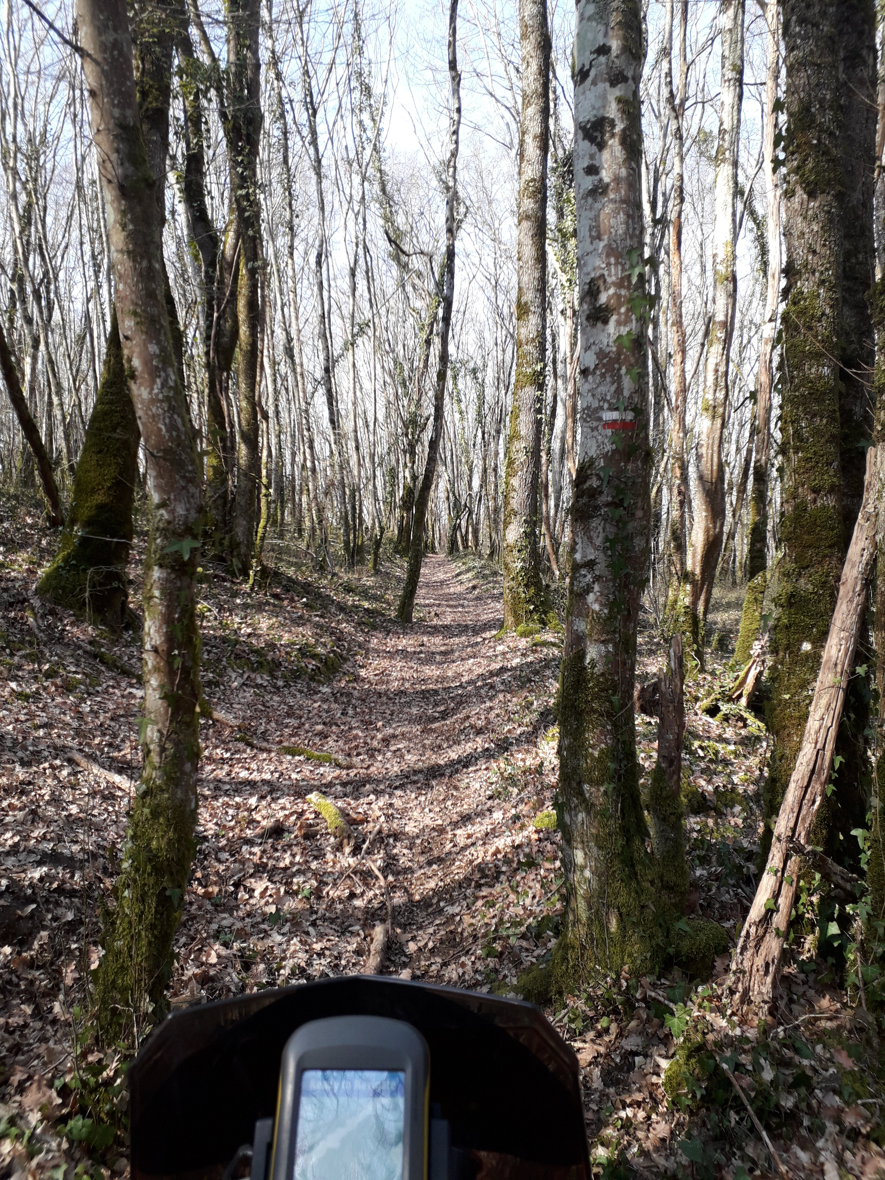 20190224_130122 by Philip Parkinson, on Flickr
Same GR as above
 20190224_125502 by Philip Parkinson, on Flickr
Further along the same GR
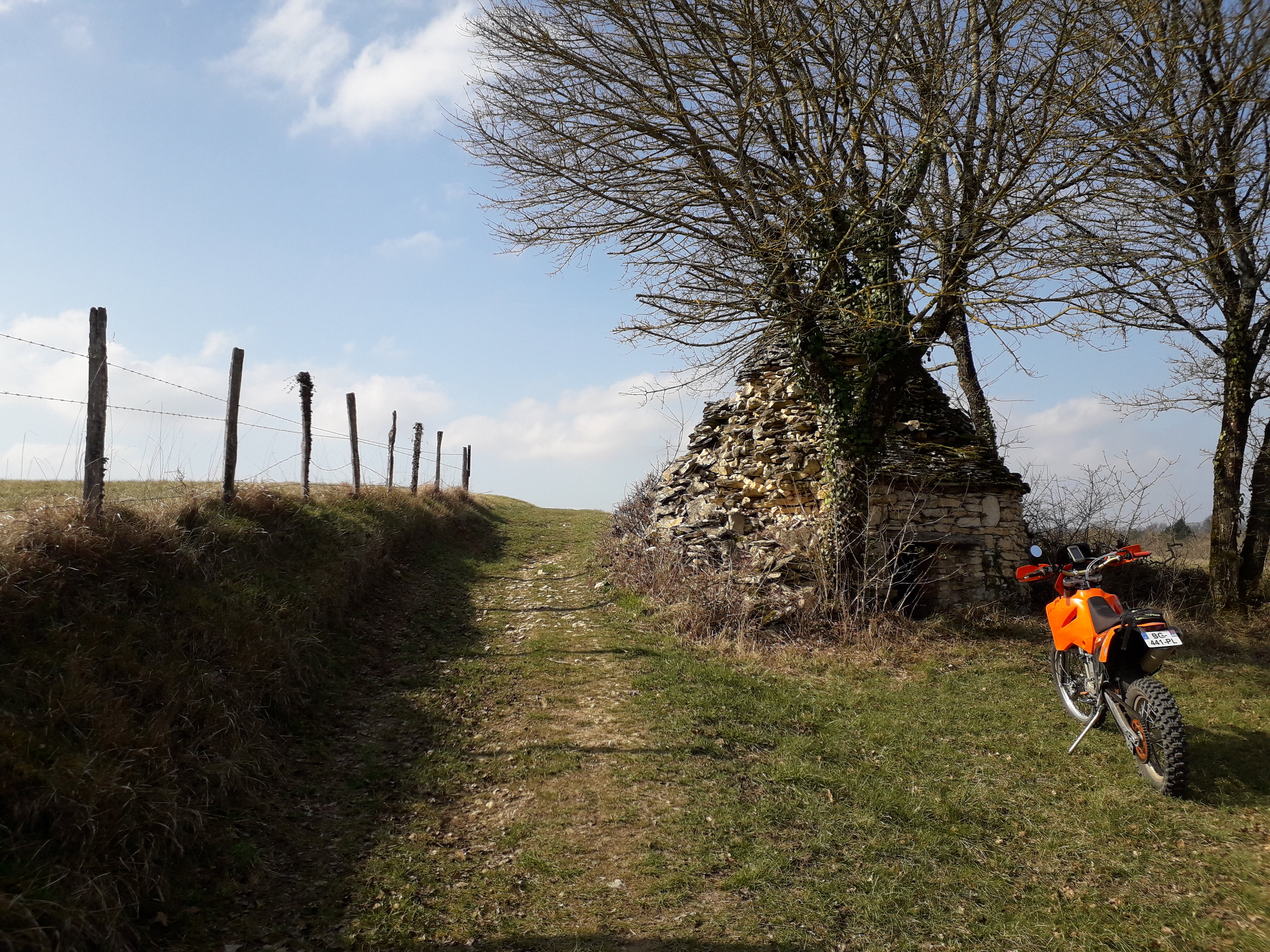 20190224_124806 by Philip Parkinson, on Flickr
And again
 20190224_152523 by Philip Parkinson, on Flickr
TOPO France is a must
The GRs can get tight
20190224_130122 by Philip Parkinson, on FlickrSame GR as above
20190224_125502 by Philip Parkinson, on FlickrFurther along the same GR
20190224_124806 by Philip Parkinson, on FlickrAnd again
20190224_152523 by Philip Parkinson, on FlickrI'M HERE FOR A GOOD TIME NOT A LONG TIME
https://www.facebook.com/groups/1806825 ... =bookmarks
https://www.youtube.com/user/PHILinFRANCE1
https://www.facebook.com/groups/1806825 ... =bookmarks
https://www.youtube.com/user/PHILinFRANCE1
