Great ride, report and photos, bravo!
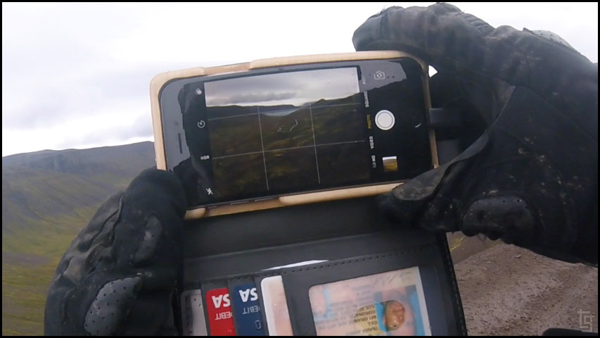
When you use the Manfrotto compact tripod, do you fire the camera remotely or set a timer?
Cheers.
Iceland and Faroe Islands - Bridge Between Continents...
-
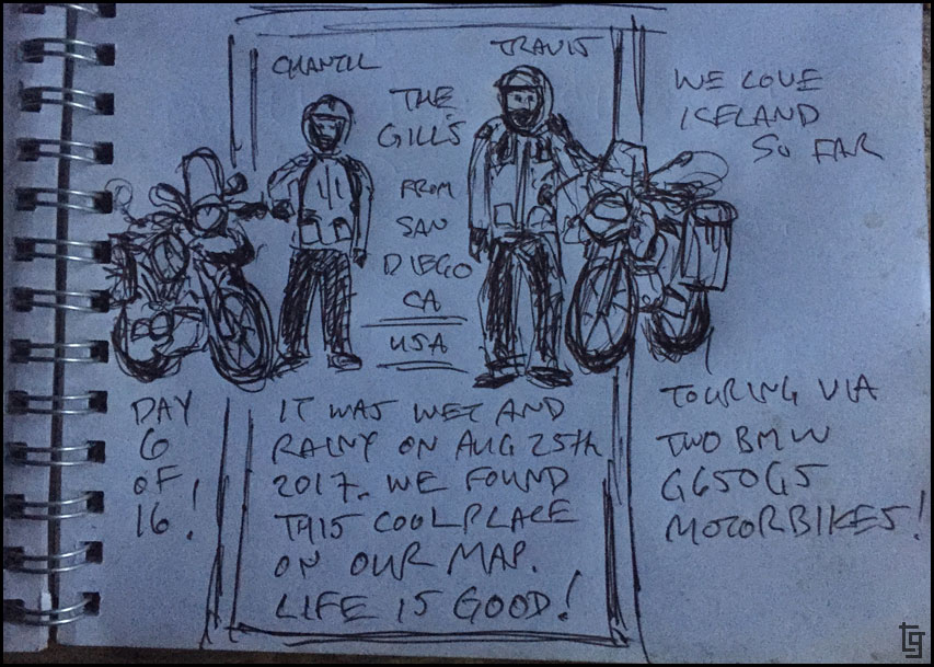
TravisGill

- Posts: 125
- Joined: Tue Apr 10, 2018 10:09 am
- Location: Germany
- Has thanked: 57 times
- Been thanked: 172 times
Re: Iceland and Faroe Islands - Bridge Between Continents...
Thanks for the kind comment! I usually shoot in video mode then convert the video to images later on the computer. The upside is I can choose the exact frame I want. The downside is you lose resolution.
-
TravisGill
- Posts: 125
- Joined: Tue Apr 10, 2018 10:09 am
- Location: Germany
- Has thanked: 57 times
- Been thanked: 172 times
Re: Iceland and Faroe Islands - Bridge Between Continents...
Iceland  Day 5 - Thu, 24 Aug 2017:
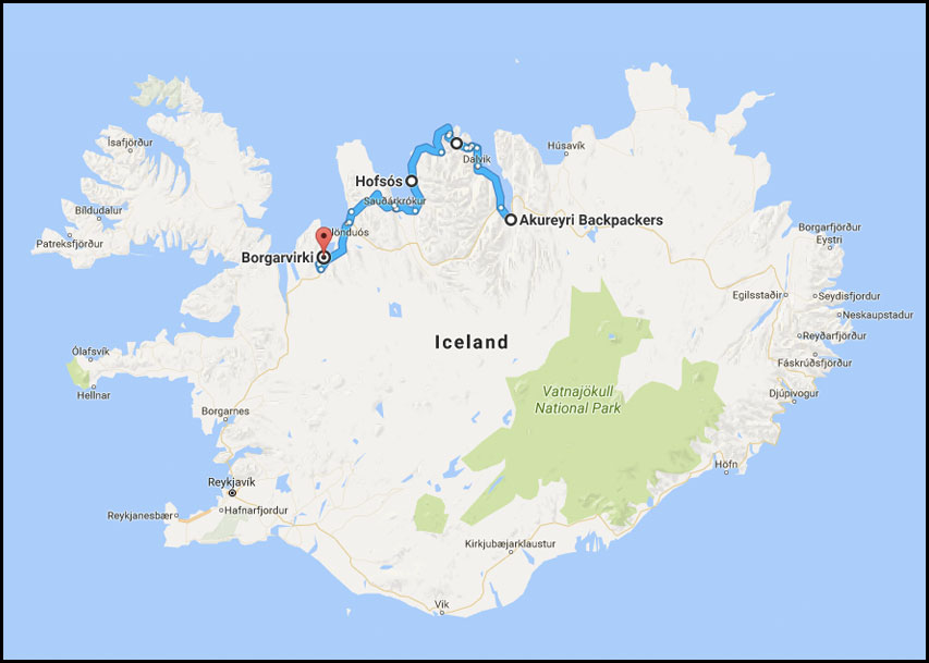
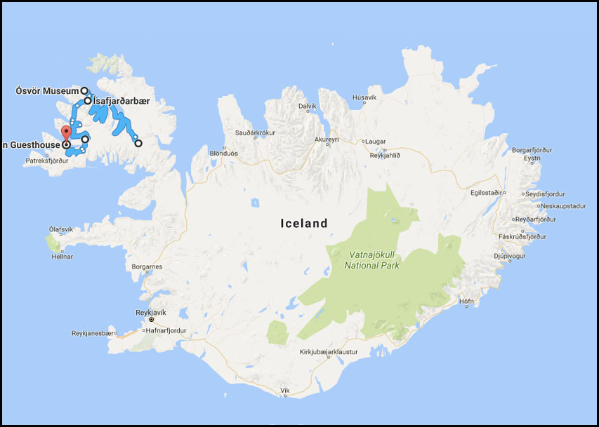
Map of Day 5
We slept in until about 8:30. I guess we were pretty tired from our highland journey or perhaps we are adjusting to an Icelander's schedule. We decided to stop by the BONUS grocery store before leaving town but once we got there we realized it doesn't open until 11AM?! We waited and did some trip planning in the parking lot. Buying groceries here is definitely the way to go if your trying to make your travel budget last; it was $30 USD for enough food to make 3-4 meals. You could easily spend that for one meal of eating out here.
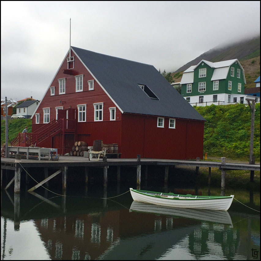
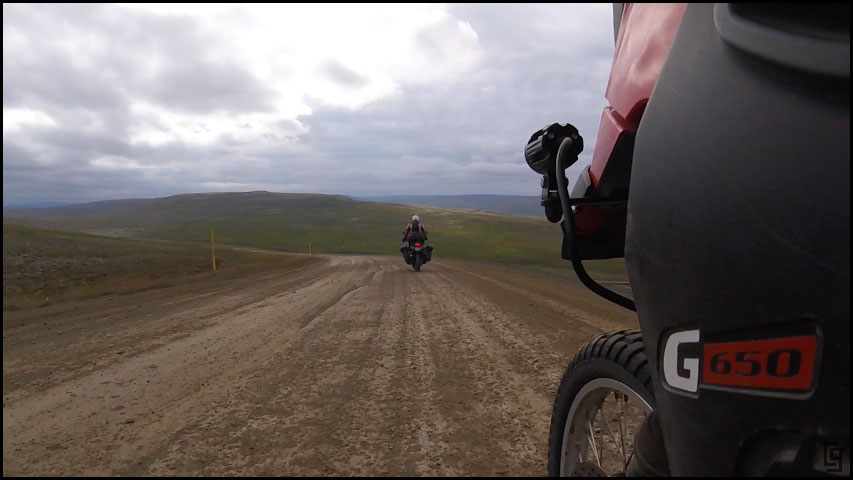
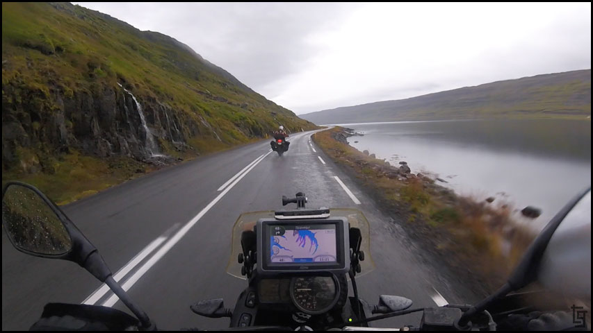
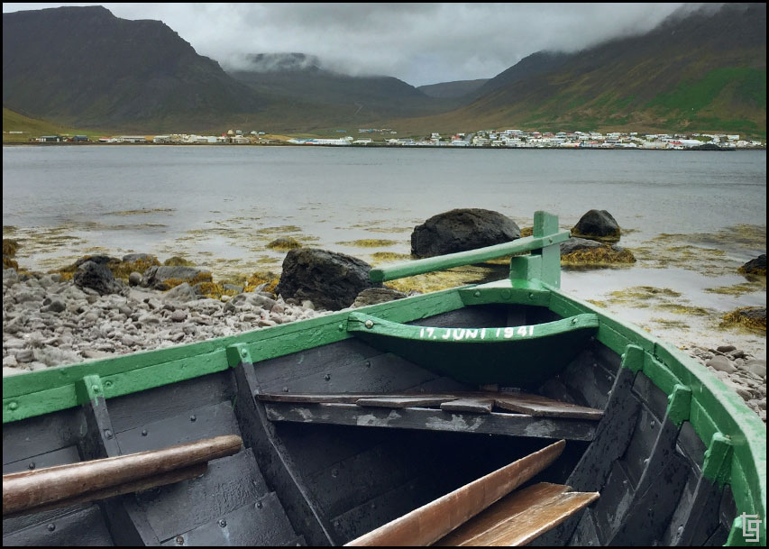
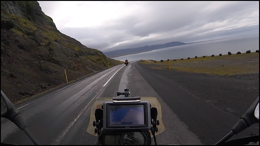
After groceries we left Akureyri, followed the 82 to Ólafsfjörður then took the 76 through the beautiful fishing town of Siglufjörður.
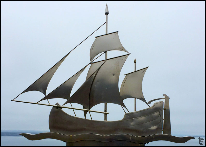
A roadside marker memorializing Eyveindor Jonsson.
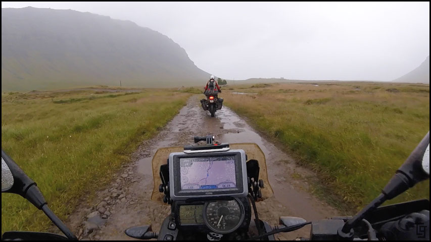
The route along the 82 and 76 featured three tunnels that were quite cool to ride through. One tunnel was only one lane and quite long (9 km) but traffic was light and we passed through easily enough.
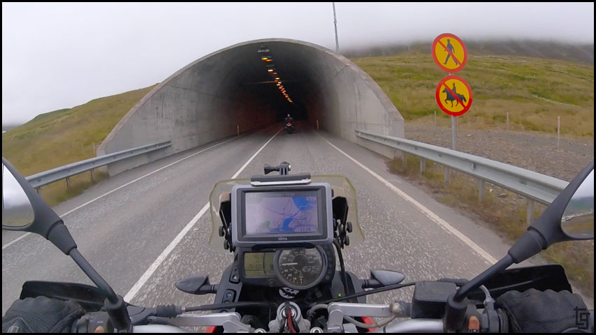
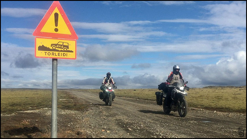
No horses - will our mules be OK to enter?
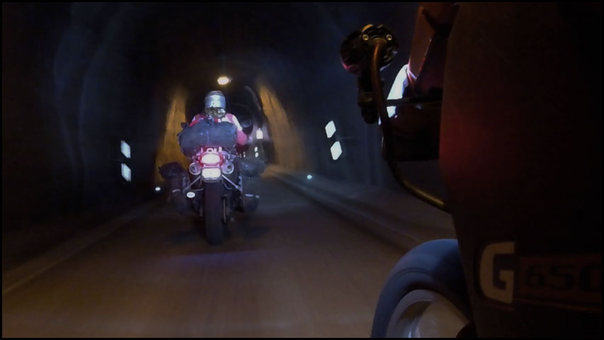
The tunnels were a bit eerie. We even pulled over and shut off the bikes to experience how dark they were.
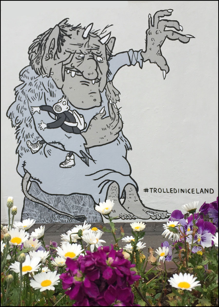
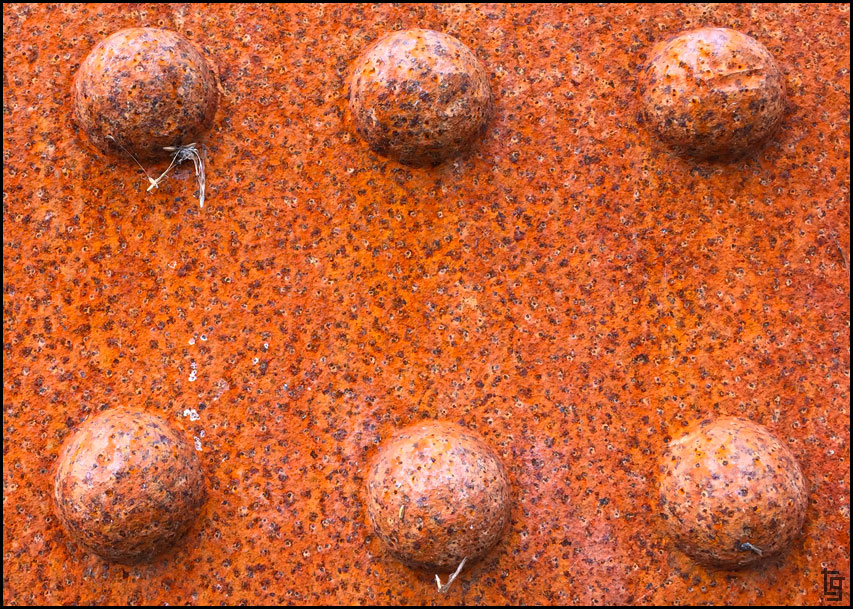
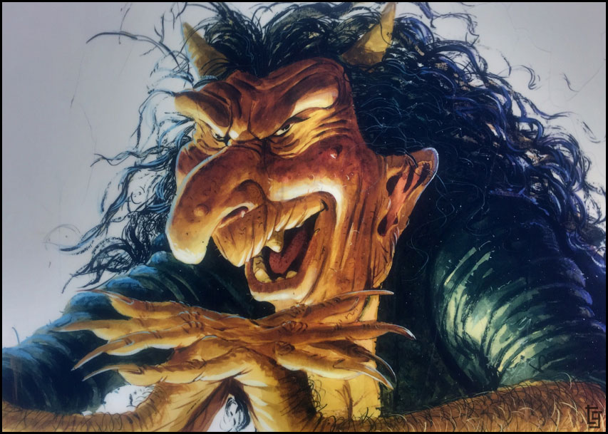
This mural was on the side of a bank. Many Icelanders enjoy tales of trolls and other mythical folklore. I hope we have enough Krona for the troll toll.
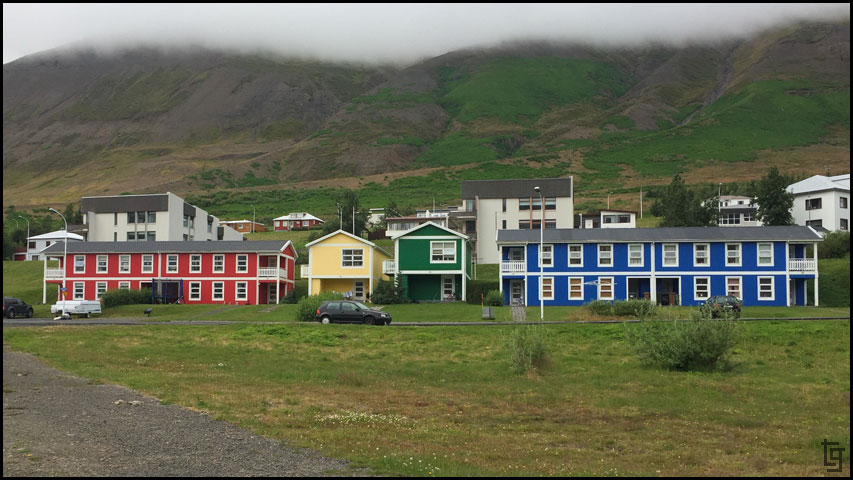
The south entrance to Siglufjörður featured these brightly colored homes. I think the Uno Card Family lives there
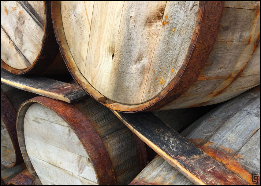
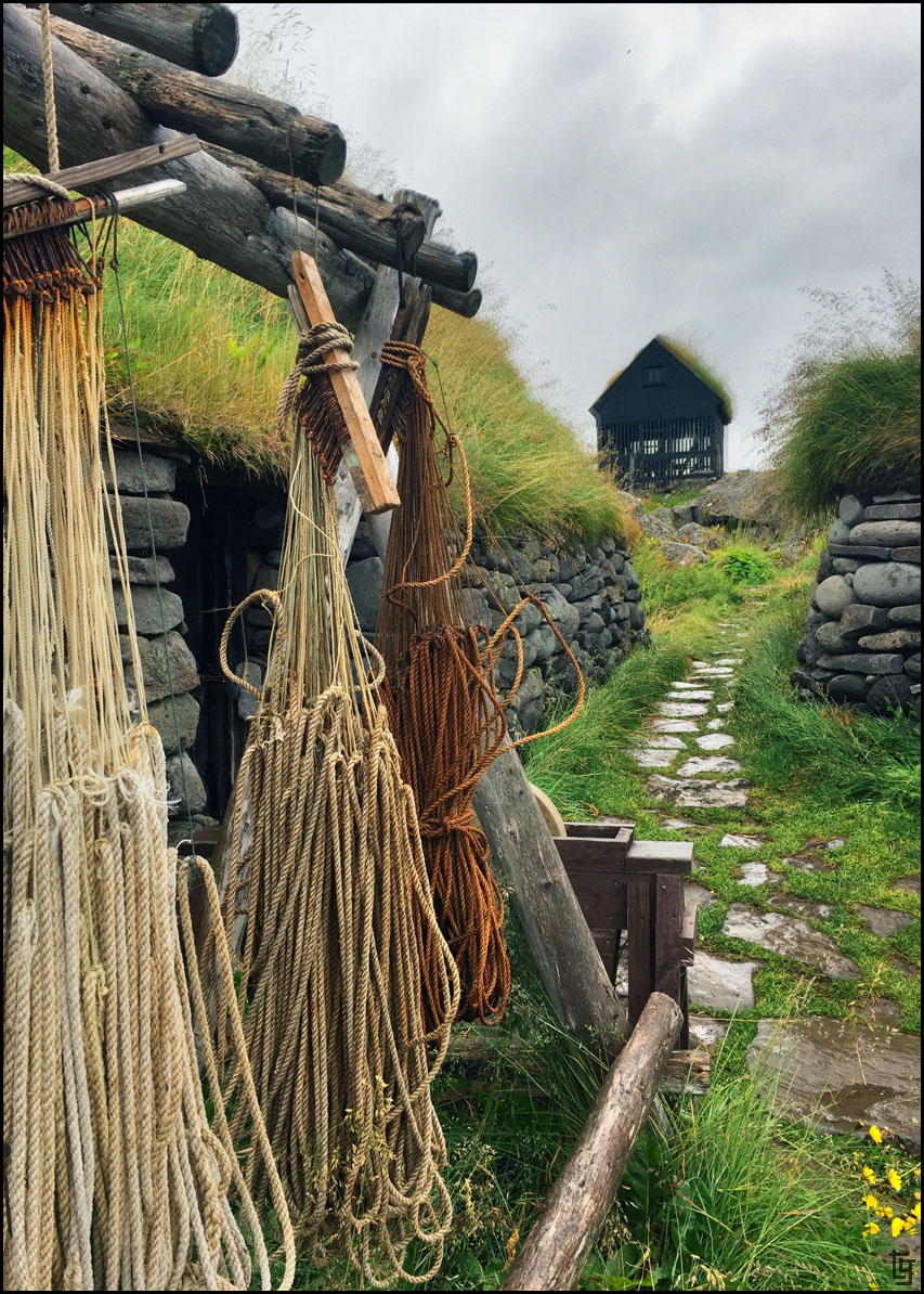
Siglufjörður also featured a beautiful museum with lots of photograph opportunities.
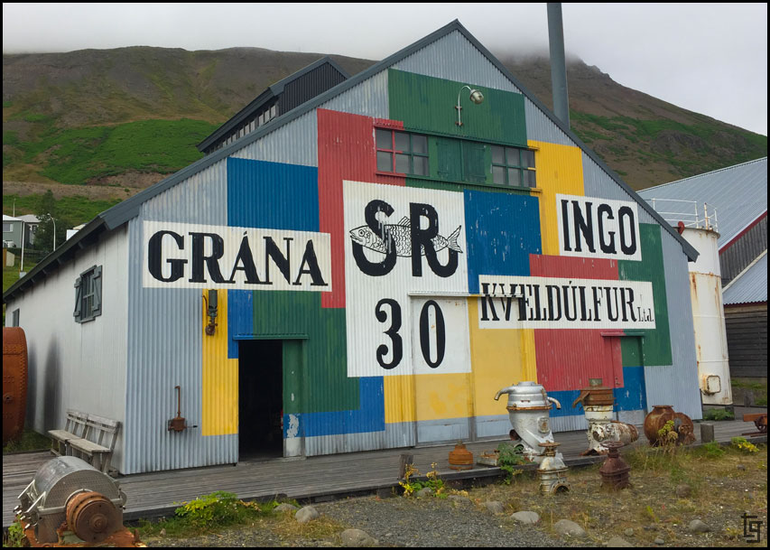
Primary colors seem to be a thing in Siglufjörður. I love the graphic nature of the type and colors.
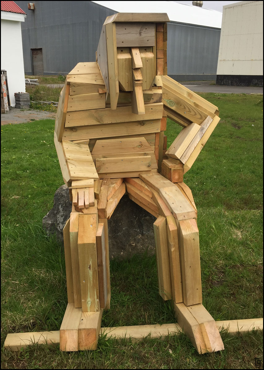
I enjoy just keeping my eyes open to cool stuff. This artist used 2x4s and other pieces of wood to make some really cool sculptures.
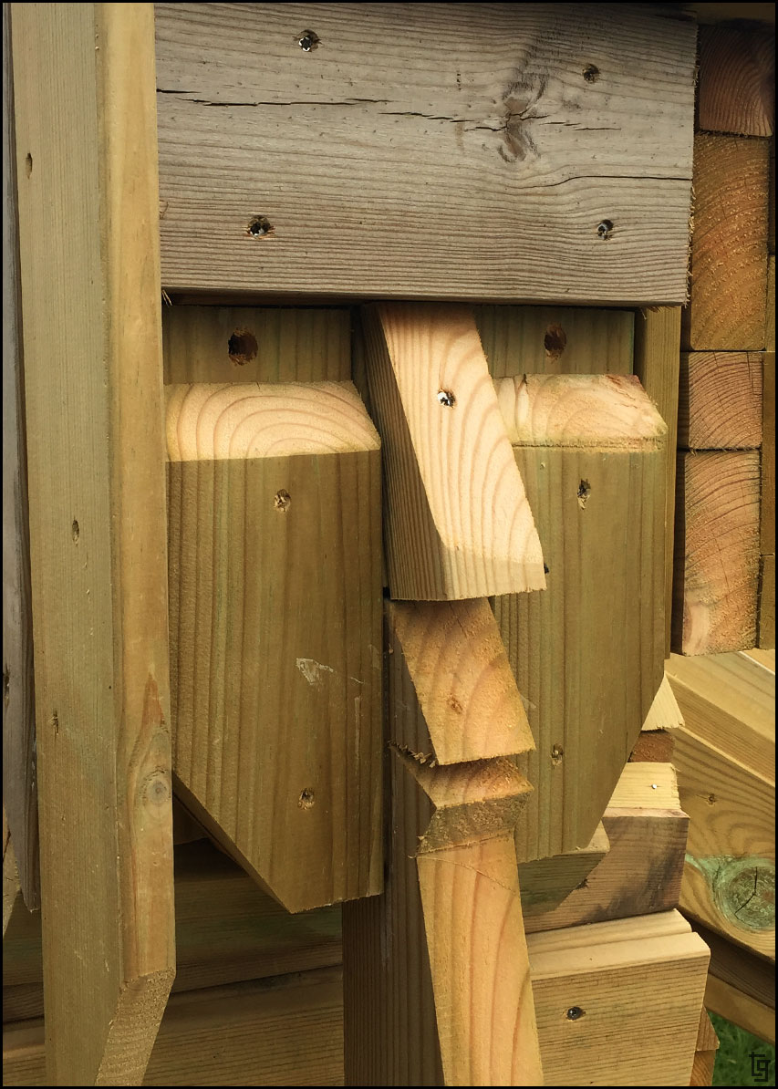
I love the rough and unfinished wood look of the sculptures.
In Siglufjörður we came across a couple from Michigan who noticed our motorcycles and the USA flags. They were quite impressed that we were on our own bikes so far away form the US. We also picked up some red-colored yarn that we'll use to mark our journeys on a wearable world map buff. Pick one up here: Horizon Ride Wear
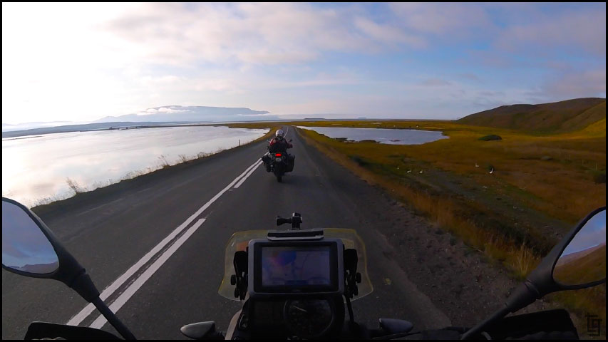
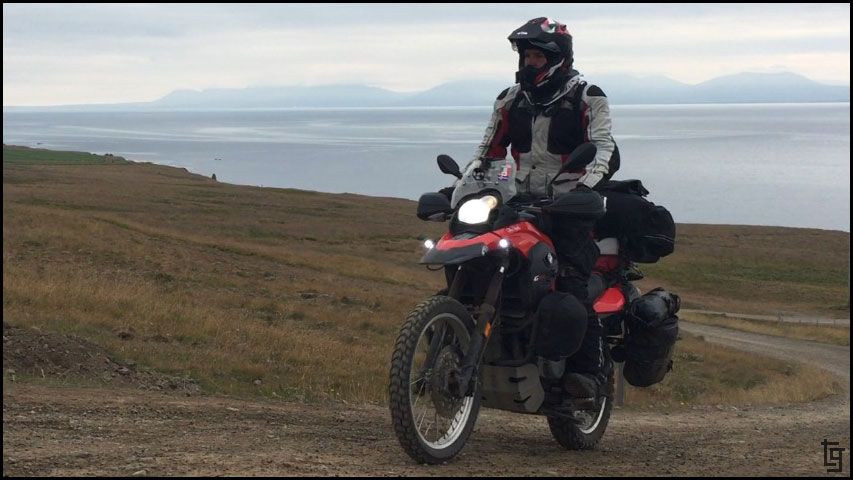
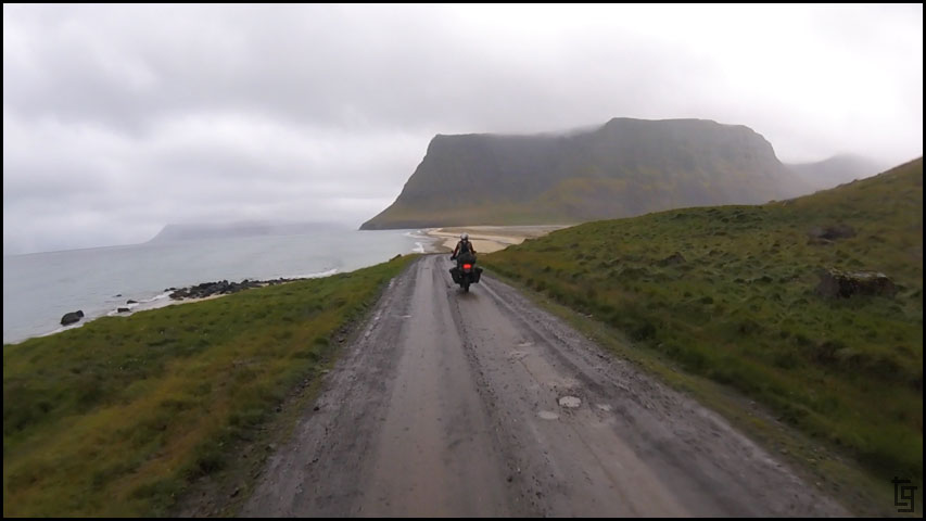
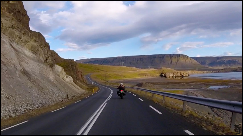
Riding right next to the ocean with minimal traffic makes for a great day on a motorcycle.
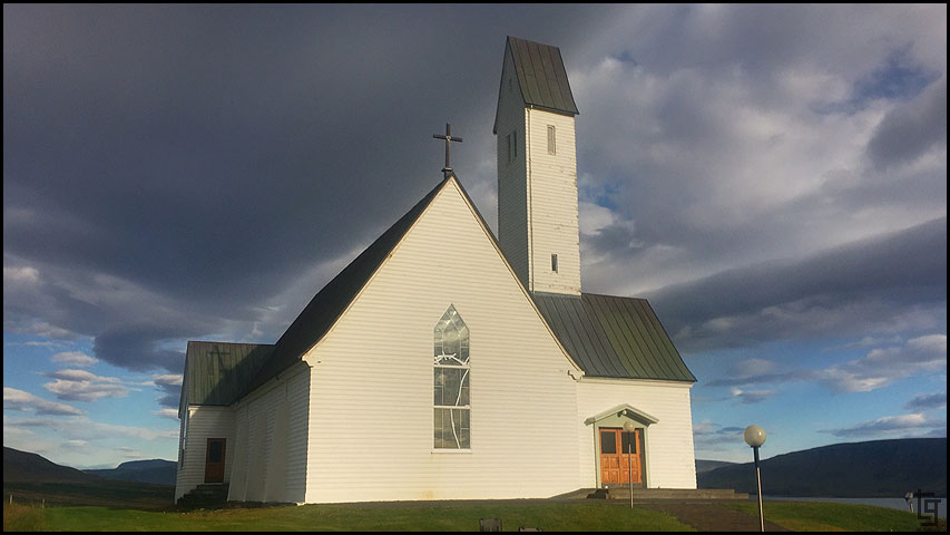
We left Siglufjörður via the 76 to Hofsós. This was one of my favorite places of the day because of Grafarkirkja - the oldest church in Iceland. We ended up being the only ones there allowing us to fly the drone around a bit and get some great video and shots.
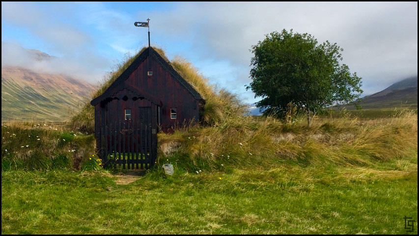
Grafarkirkja, the oldest church is Iceland is on a beautiful plot of picture perfect land.
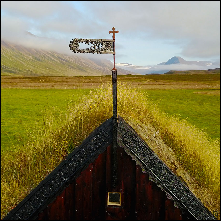
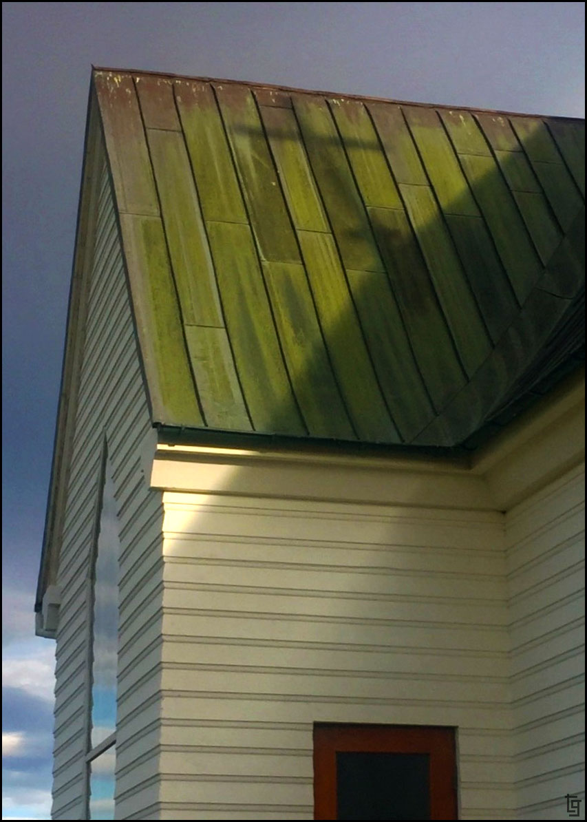
Ornate top of church captured with Mavic drone.
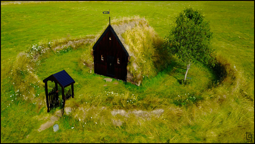
Grafarkirkja, captured via Mavic drone.
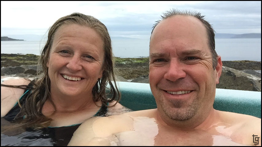
We ride back into Siglufjörður where we stopped by the hot pools, and found an early dinner at the Sólvik restaurant.
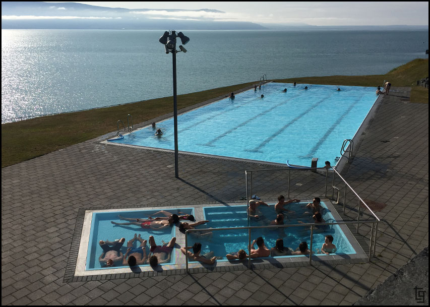
The public pool at Siglufjörður. Notice how popular the hot tub is Because of this we decided to skip this one and get some dinner.
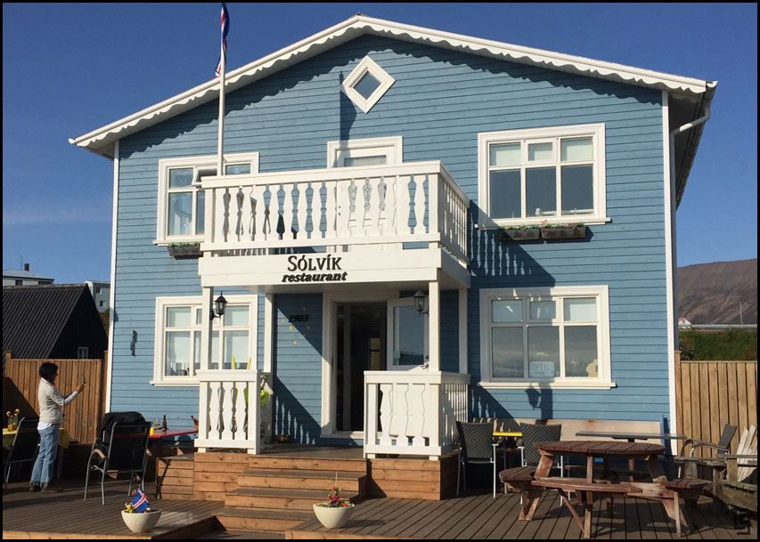
The Sólvik restaurant was a great place to eat outside and enjoy the view of the bay and warm sun.
While we waited we caught up on life using the free WiFi. What's the code? This seerstone shall reveal the secret code First time I’ve seen that.
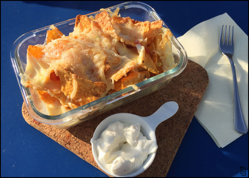
Nachos Icelandic style.
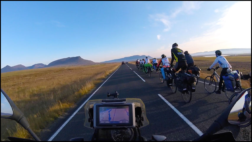
Shortly after returning to the main road we came across three groups of at least 20-30 bicycle riders. I imagine bicycling around Iceland would be quite the adventure!
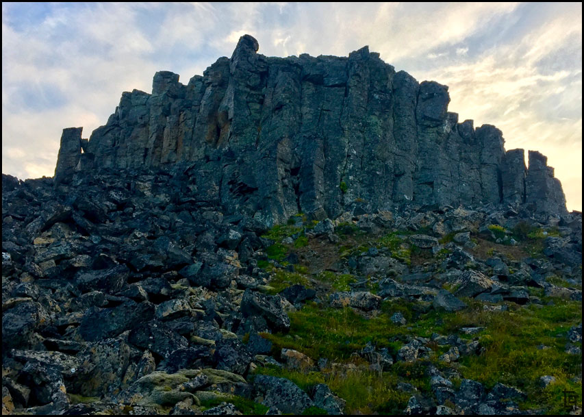
After reaching Borgarvirki we explored a bit and determined that this would be a great place to camp for the night. It was quite, protected by the wind, and had a great view of the fjords below.
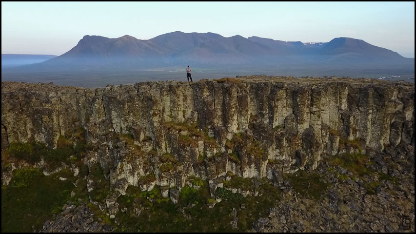
Large Basalt cliffs on a hill made for a natural fortress from potential enemies.
View from our camp site
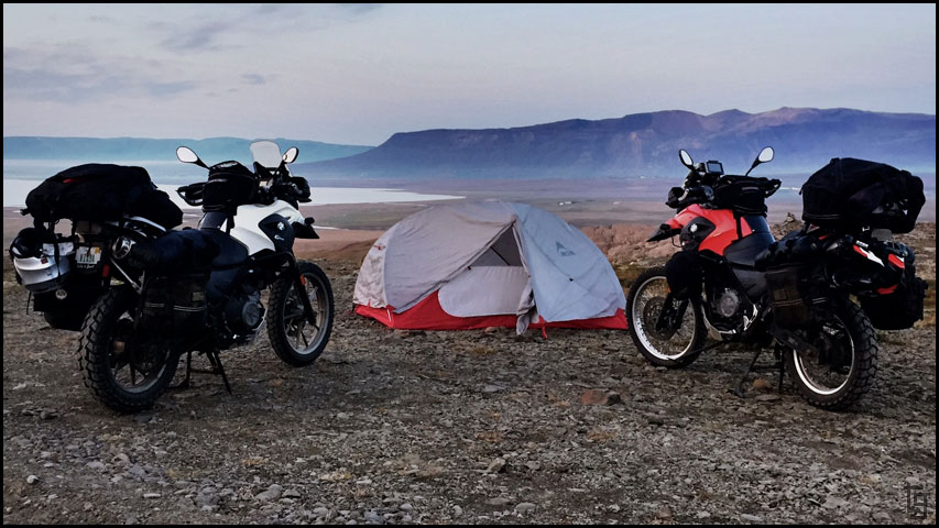
A beautiful place to call it a night.
Until tomorrow where we venture into the West Fjords...
Day 5 - Thu, 24 Aug 2017:Map of Day 5
We slept in until about 8:30. I guess we were pretty tired from our highland journey or perhaps we are adjusting to an Icelander's schedule. We decided to stop by the BONUS grocery store before leaving town but once we got there we realized it doesn't open until 11AM?! We waited and did some trip planning in the parking lot. Buying groceries here is definitely the way to go if your trying to make your travel budget last; it was $30 USD for enough food to make 3-4 meals. You could easily spend that for one meal of eating out here.
After groceries we left Akureyri, followed the 82 to Ólafsfjörður then took the 76 through the beautiful fishing town of Siglufjörður.
A roadside marker memorializing Eyveindor Jonsson.
The route along the 82 and 76 featured three tunnels that were quite cool to ride through. One tunnel was only one lane and quite long (9 km) but traffic was light and we passed through easily enough.
No horses - will our mules be OK to enter?
The tunnels were a bit eerie. We even pulled over and shut off the bikes to experience how dark they were.
This mural was on the side of a bank. Many Icelanders enjoy tales of trolls and other mythical folklore. I hope we have enough Krona for the troll toll.
The south entrance to Siglufjörður featured these brightly colored homes. I think the Uno Card Family lives there
Siglufjörður also featured a beautiful museum with lots of photograph opportunities.
Primary colors seem to be a thing in Siglufjörður. I love the graphic nature of the type and colors.
I enjoy just keeping my eyes open to cool stuff. This artist used 2x4s and other pieces of wood to make some really cool sculptures.
I love the rough and unfinished wood look of the sculptures.
In Siglufjörður we came across a couple from Michigan who noticed our motorcycles and the USA flags. They were quite impressed that we were on our own bikes so far away form the US. We also picked up some red-colored yarn that we'll use to mark our journeys on a wearable world map buff. Pick one up here: Horizon Ride Wear
Riding right next to the ocean with minimal traffic makes for a great day on a motorcycle.
We left Siglufjörður via the 76 to Hofsós. This was one of my favorite places of the day because of Grafarkirkja - the oldest church in Iceland. We ended up being the only ones there allowing us to fly the drone around a bit and get some great video and shots.
Grafarkirkja, the oldest church is Iceland is on a beautiful plot of picture perfect land.
Ornate top of church captured with Mavic drone.
Grafarkirkja, captured via Mavic drone.
We ride back into Siglufjörður where we stopped by the hot pools, and found an early dinner at the Sólvik restaurant.
The public pool at Siglufjörður. Notice how popular the hot tub is
The Sólvik restaurant was a great place to eat outside and enjoy the view of the bay and warm sun.
While we waited we caught up on life using the free WiFi. What's the code? This seerstone shall reveal the secret code
Nachos Icelandic style.
Shortly after returning to the main road we came across three groups of at least 20-30 bicycle riders. I imagine bicycling around Iceland would be quite the adventure!
After reaching Borgarvirki we explored a bit and determined that this would be a great place to camp for the night. It was quite, protected by the wind, and had a great view of the fjords below.
Large Basalt cliffs on a hill made for a natural fortress from potential enemies.
View from our camp site
A beautiful place to call it a night.
Until tomorrow where we venture into the West Fjords...
Last edited by TravisGill on Sun Apr 15, 2018 12:31 am, edited 1 time in total.
-
daveuprite
- Posts: 4790
- Joined: Fri Dec 28, 2012 10:47 pm
- Location: Limousin France
- Has thanked: 2452 times
- Been thanked: 3293 times
Re: Iceland and Faroe Islands - Bridge Between Continents...
Great thread. Really like the 'arty' shots of stuff that people often ignore. Best photo record of Iceland I've seen. Looking forward to next installment.
-
chunky butt

- Posts: 2036
- Joined: Thu Nov 13, 2014 10:39 pm
- Has thanked: 54 times
- Been thanked: 699 times
Re: Iceland and Faroe Islands - Bridge Between Continents...
Great photos there, and ride report......thanks for posting
-
TravisGill
- Posts: 125
- Joined: Tue Apr 10, 2018 10:09 am
- Location: Germany
- Has thanked: 57 times
- Been thanked: 172 times
Re: Iceland and Faroe Islands - Bridge Between Continents...
Iceland Day 6 - Fri, 25 Aug 17:
Map of Day 6
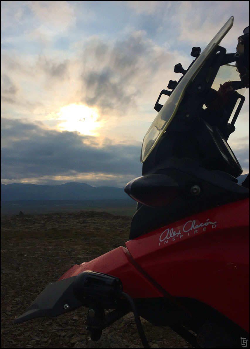
We got an early start today helped by an incredible sunrise. The sunrises and sunsets last quite a long time when you are this far north. After packing up our tent and checking over the mules, we were leaving the road from Borgarvirki by 8AM; early by our standards.
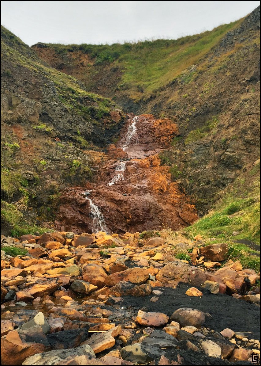
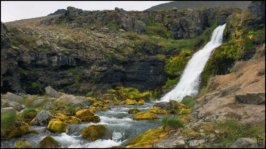
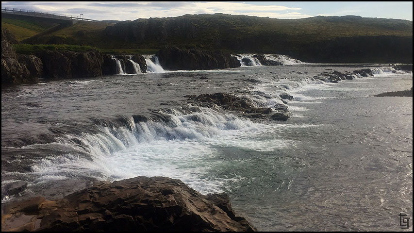
One of the falls along the way
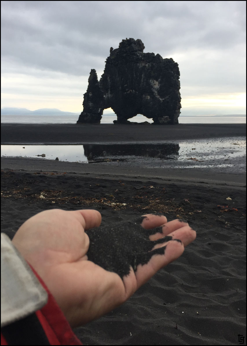
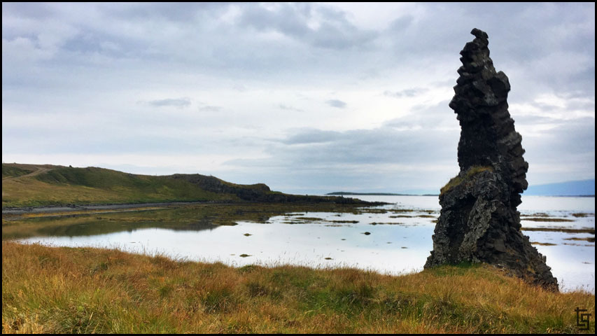
The black volcanic sand with Hvitserkur - the remains of a troll that rose from the ocean but was turned to stone.
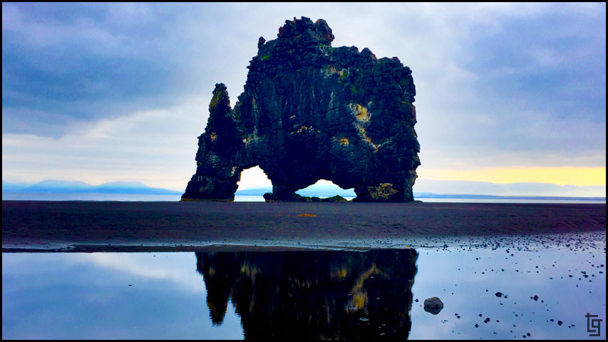
Hvitserkur in the morning light
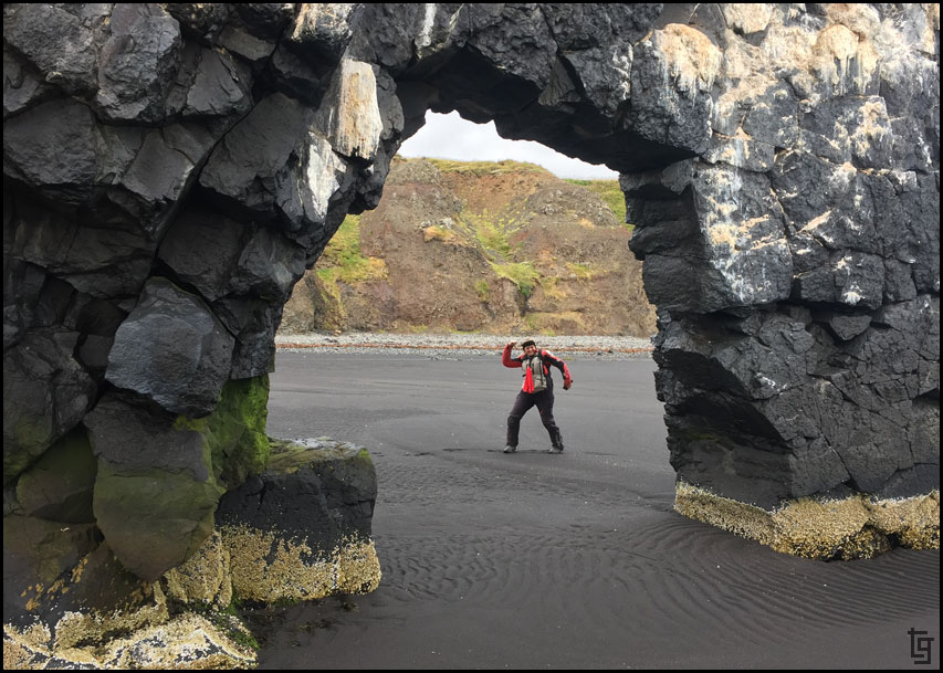
Chantil enjoying the morning walk around Hvitserkur
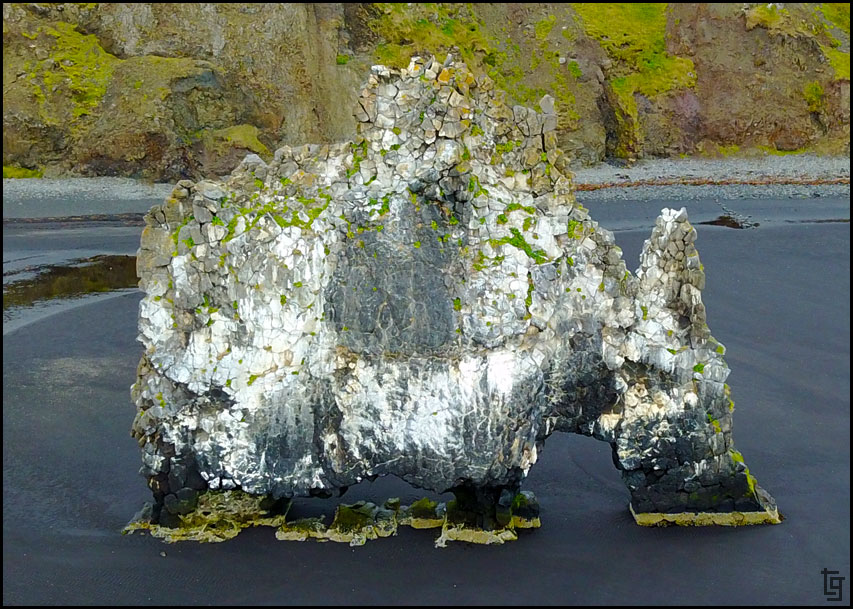
The ocean side of Hvitserkur looks completely different.
Leaving Hvitserkur
We continued along the coast via the 71 and came across the Geitafell restaurant. It was almost lunch so we thought "why not?" So glad we did! The seafood soup and desert cake was delicious. A real unexpected treat.
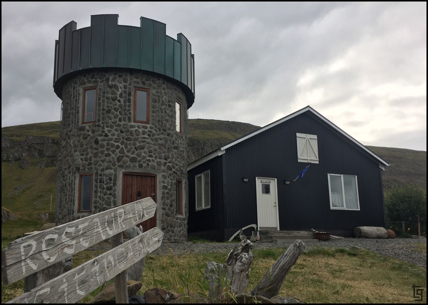
A restaurant with it's own tower has to be good, right?
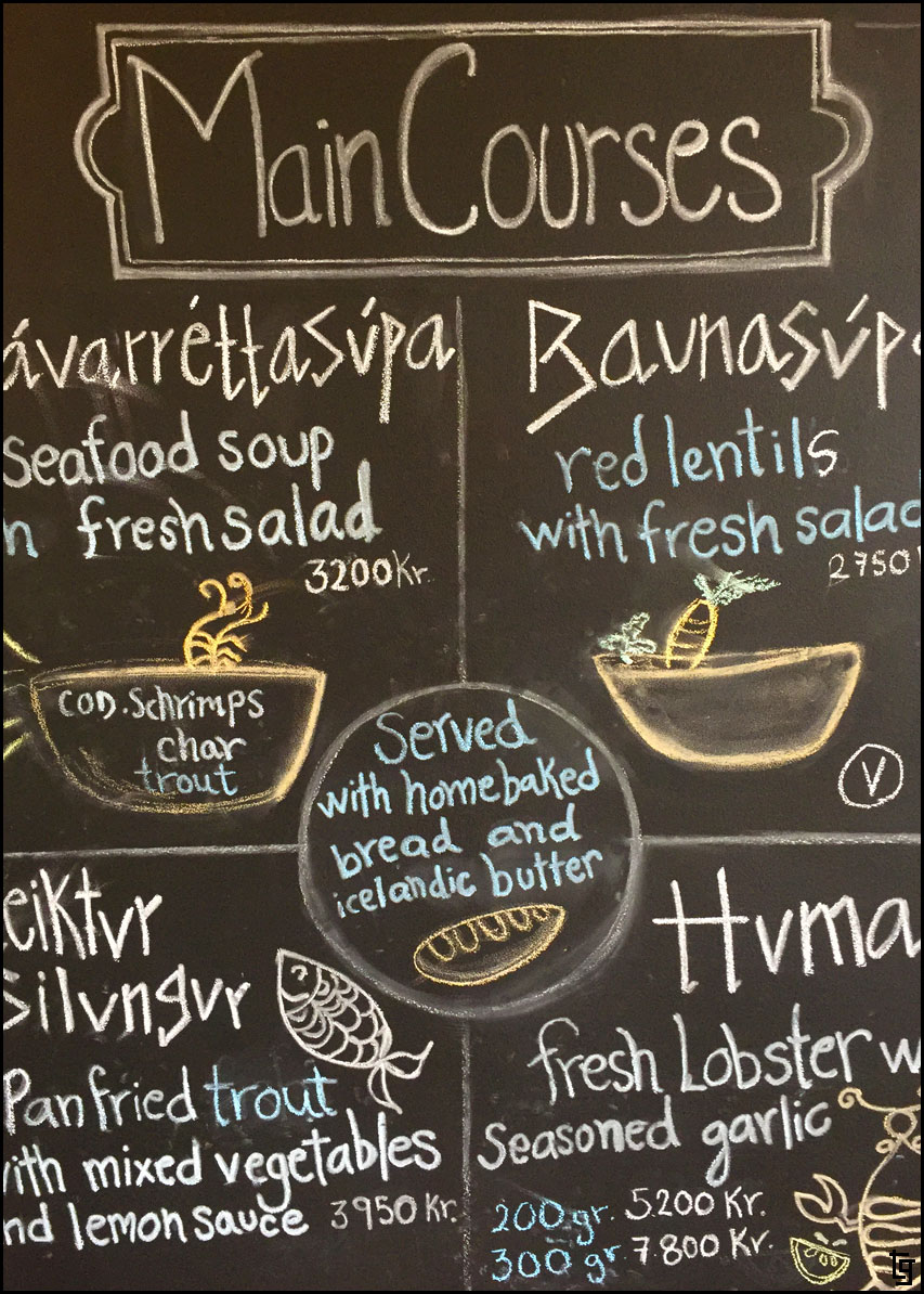
A simple, chalk-written, menu lists the main meals and desserts.
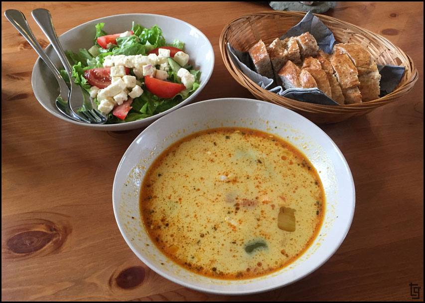
We decided on the fish soup. Delicious.
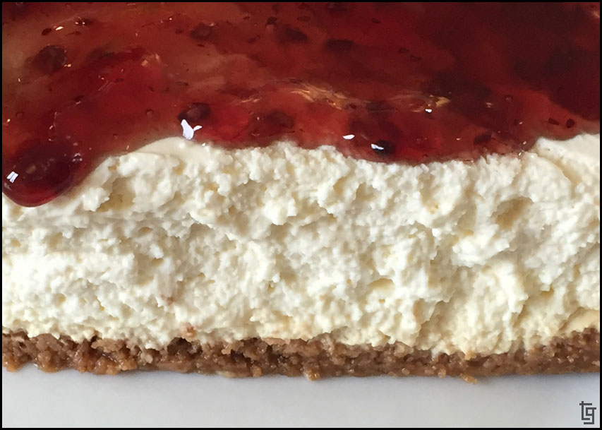
And the Skyrterta - a skyrcake with blueberry jam.
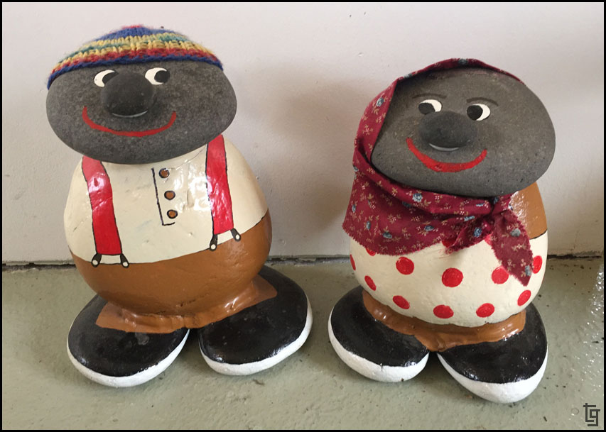
Rock kids at the Geitafell restaurant.
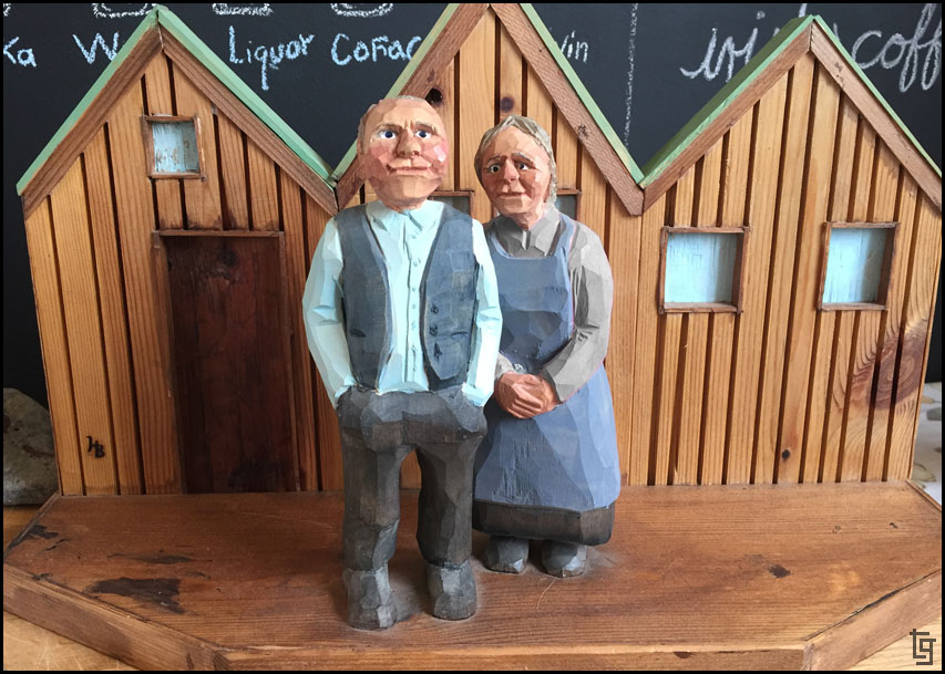
More art inside the restaurant.
Further along the 71 we came across Hamarsrétt, an interesting circular fenced area for horses. We spoke to in interesting German family who invited us to visit if we are in the area.
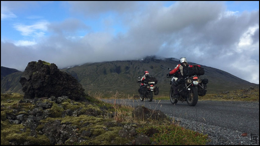
A bit of off-road riding today.
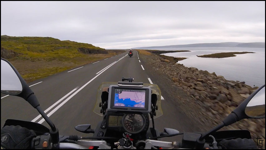
The 68 is the gateway to the Western Fjords. Travel is slow but beautiful as we winded along the two, and sometimes one-lane, roads. There are also a few tunnels that were fun to ride through.
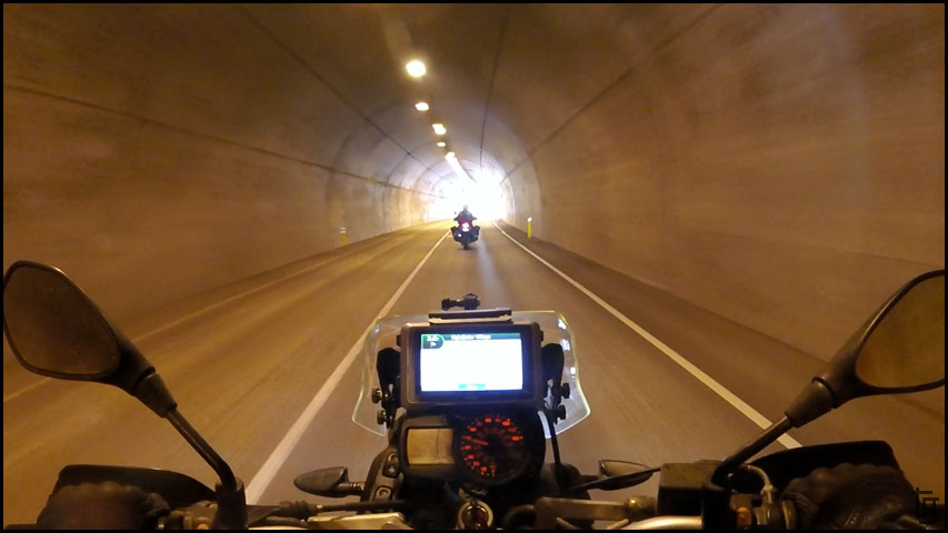
Enjoying the tunnels that make travel through the West Fjords easier.
An interesting structure along the 68. Troll's finger?
Who needs guard-rails when you have jagged volcanic rock and arctic waters to break your fall?
We continues winding along until we reached the Drangsnes Hot Pots which offered another opportunity to chill in the thermal waters of Iceland.
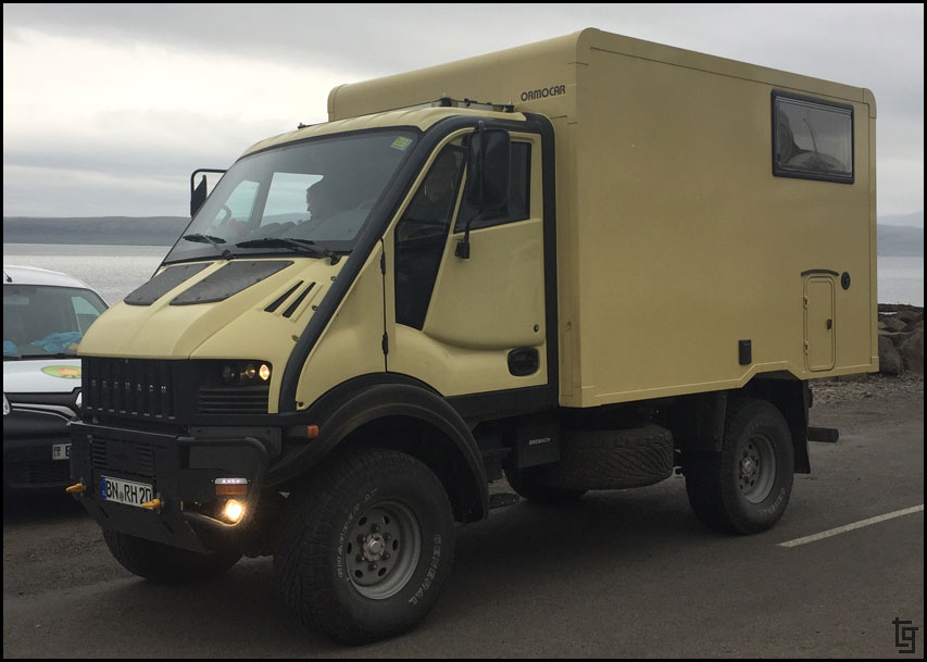
Saw this really cool overlander from Germany. I can't imagine the diesel fuel costs though.
The weather was getting worse so we did our best to make progress but it became challenging once the fog got thick and the rain intensified.
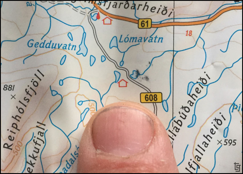
Wait... What is this tiny red house symbol on the map?
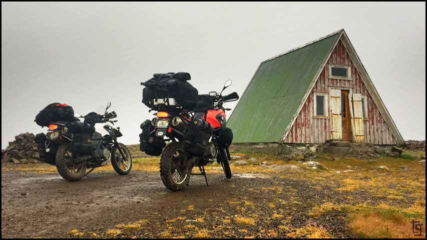
I was not enthusiastic about finding a place since it was a Friday and would most likely be occupied already. Fortunately, we were blessed; just off the main road we came across a travelers hut that offered refuge from the storm.
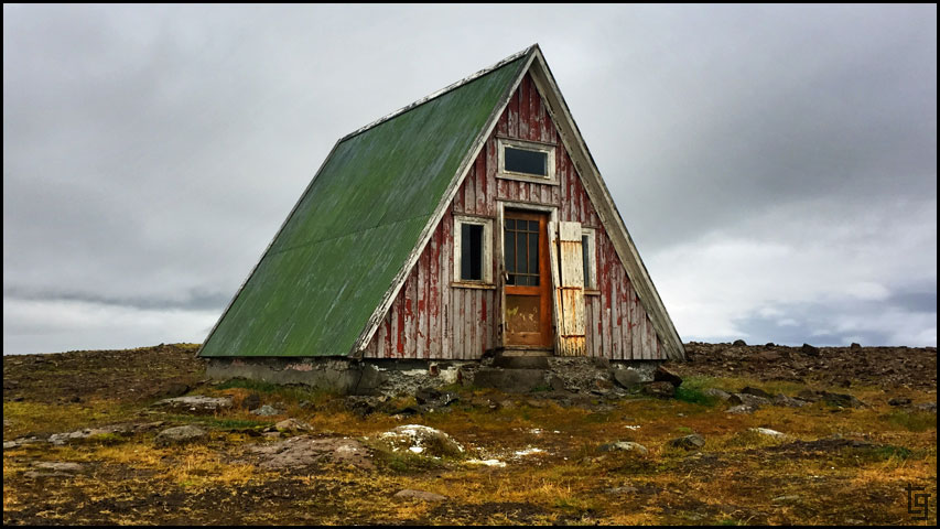
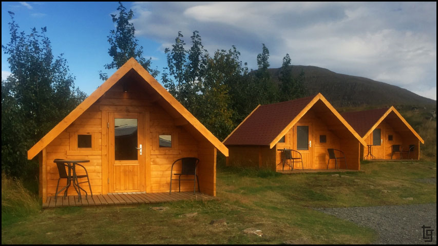
Our home for the night. What do you think?
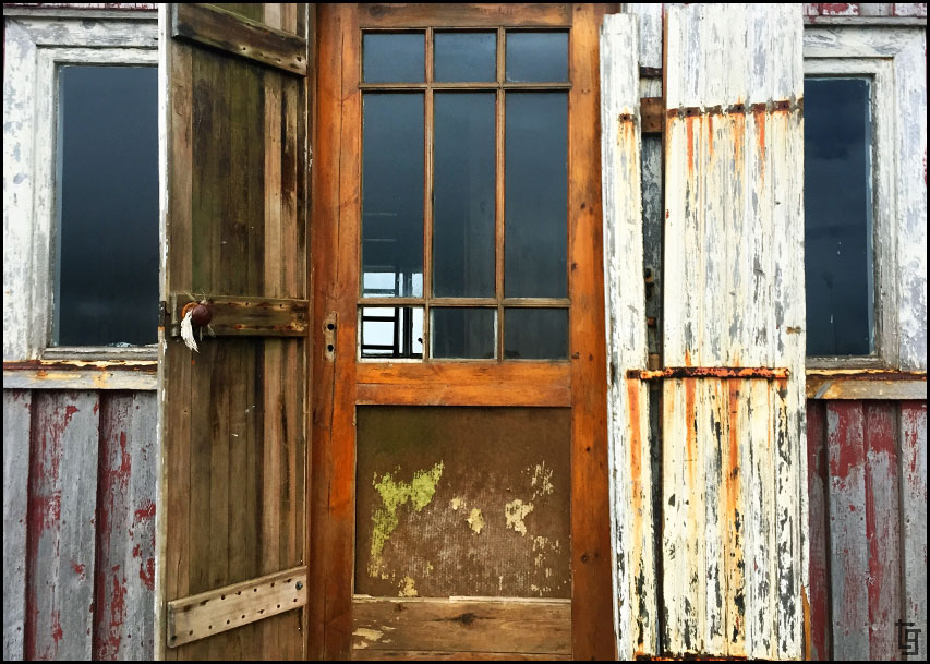
The front door could use some work but it was dry and provided refuge from the storm. A perfect place.
Signing the guest book found inside the travelers hut.
Looking forward to a cozy night without rain and a morning without having to put away a wet tent. Until tomorrow...
Day 6 - Fri, 25 Aug 17:Map of Day 6
We got an early start today helped by an incredible sunrise. The sunrises and sunsets last quite a long time when you are this far north. After packing up our tent and checking over the mules, we were leaving the road from Borgarvirki by 8AM; early by our standards.
One of the falls along the way
The black volcanic sand with Hvitserkur - the remains of a troll that rose from the ocean but was turned to stone.
Hvitserkur in the morning light
Chantil enjoying the morning walk around Hvitserkur
The ocean side of Hvitserkur looks completely different.
Leaving Hvitserkur
We continued along the coast via the 71 and came across the Geitafell restaurant. It was almost lunch so we thought "why not?" So glad we did! The seafood soup and desert cake was delicious. A real unexpected treat.
A restaurant with it's own tower has to be good, right?
A simple, chalk-written, menu lists the main meals and desserts.
We decided on the fish soup. Delicious.
And the Skyrterta - a skyrcake with blueberry jam.
Rock kids at the Geitafell restaurant.
More art inside the restaurant.
Further along the 71 we came across Hamarsrétt, an interesting circular fenced area for horses. We spoke to in interesting German family who invited us to visit if we are in the area.
A bit of off-road riding today.
The 68 is the gateway to the Western Fjords. Travel is slow but beautiful as we winded along the two, and sometimes one-lane, roads. There are also a few tunnels that were fun to ride through.
Enjoying the tunnels that make travel through the West Fjords easier.
An interesting structure along the 68. Troll's finger?
Who needs guard-rails when you have jagged volcanic rock and arctic waters to break your fall?
We continues winding along until we reached the Drangsnes Hot Pots which offered another opportunity to chill in the thermal waters of Iceland.
Saw this really cool overlander from Germany. I can't imagine the diesel fuel costs though.
The weather was getting worse so we did our best to make progress but it became challenging once the fog got thick and the rain intensified.
Wait... What is this tiny red house symbol on the map?
I was not enthusiastic about finding a place since it was a Friday and would most likely be occupied already. Fortunately, we were blessed; just off the main road we came across a travelers hut that offered refuge from the storm.
Our home for the night. What do you think?
The front door could use some work but it was dry and provided refuge from the storm. A perfect place.
Signing the guest book found inside the travelers hut.
Looking forward to a cozy night without rain and a morning without having to put away a wet tent. Until tomorrow...
-
TravisGill
- Posts: 125
- Joined: Tue Apr 10, 2018 10:09 am
- Location: Germany
- Has thanked: 57 times
- Been thanked: 172 times
Re: Iceland and Faroe Islands - Bridge Between Continents...
Iceland Day 7 - Sat, 26 Aug 17:
Map of Day 7
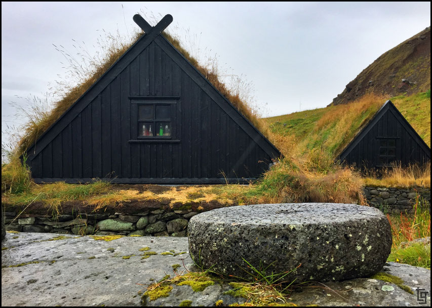
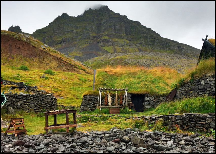
It was a blessing to have the A-frame shelter last night. In the sleeping loft were some mattresses that when combined with our air mattress pads and sleeping bags made for a great night of sleep. I really didn't want to get up in the morning but we still had some places to explore so off we went.
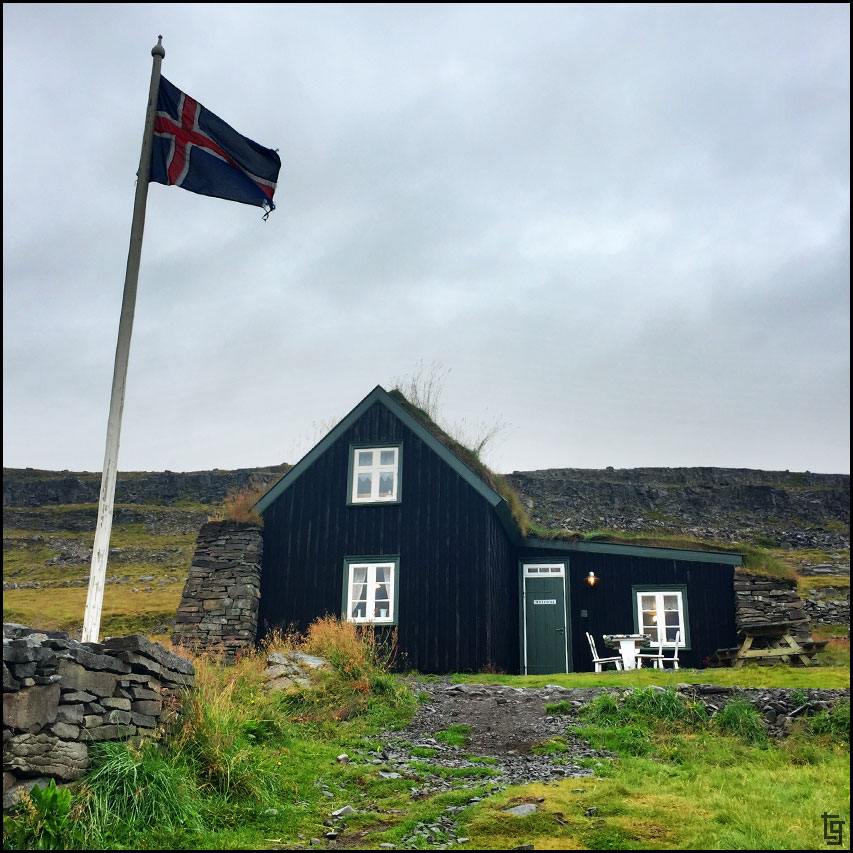
Our first stop was to a roadside restaurant and museum.
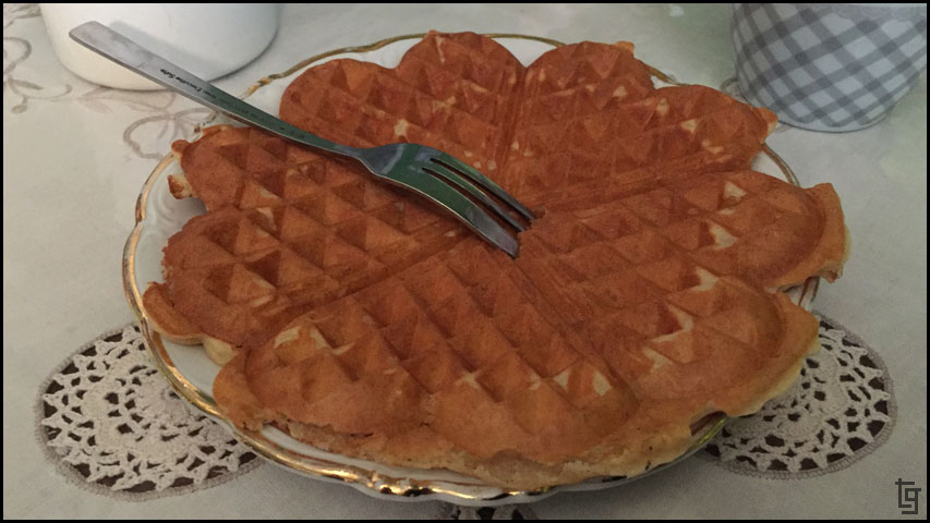
The service was nice and the hot chocolate and waffles were exactly what we needed to continue our day of adventure.
Our next stop was in Ísafjarðarbær to top off our groceries of mostly kinder chocolates
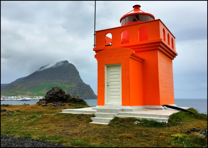
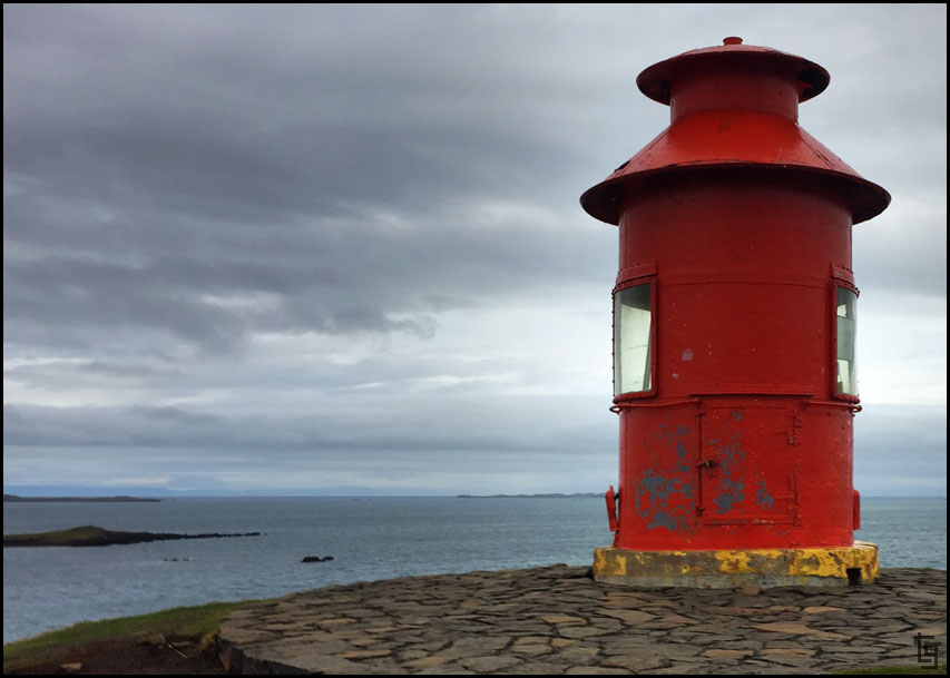
Orange lighthouse makes for a short picture spot.
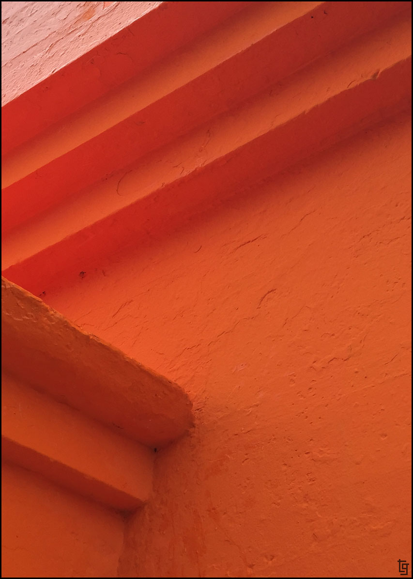
Abstract memory of the lighthouse.
The rain is already starting with the forecast calling for heavy rain all day.
A bit past town we arrived at the Mariners Museum but it was closed. Since much of the displays were outdoors we still got to explore and take some pictures.
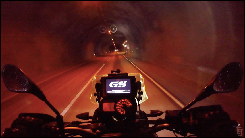
Another tunnel making access between the small villages easier.

We returned to Ísafjarðarbær where we gassed up the mules and we tried our first SS Icelandic hotdog - apparently world famous.
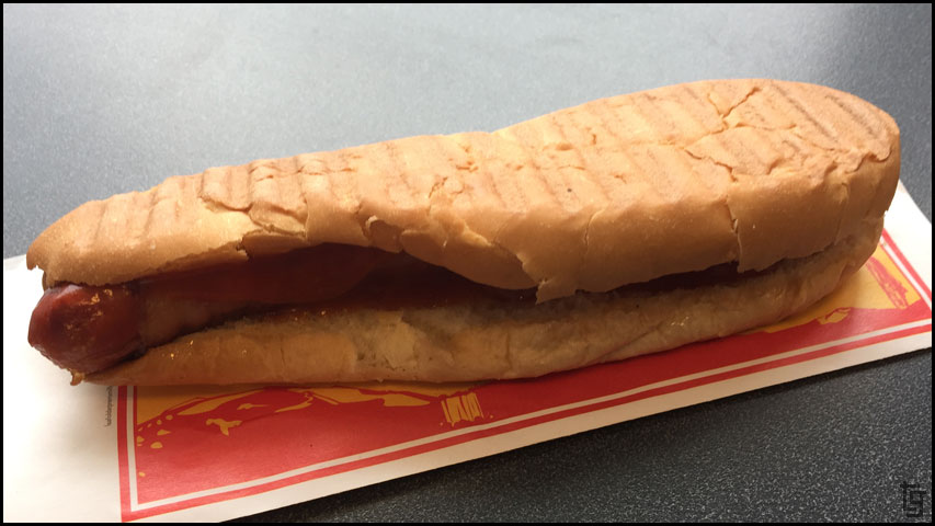
Bacon wrapped hotdog inside a toasted bun that looks like it was stepped on by a work boot. How was it? Mostly anything wrapped in bacon is delicious - so yea, it was good. Not great.
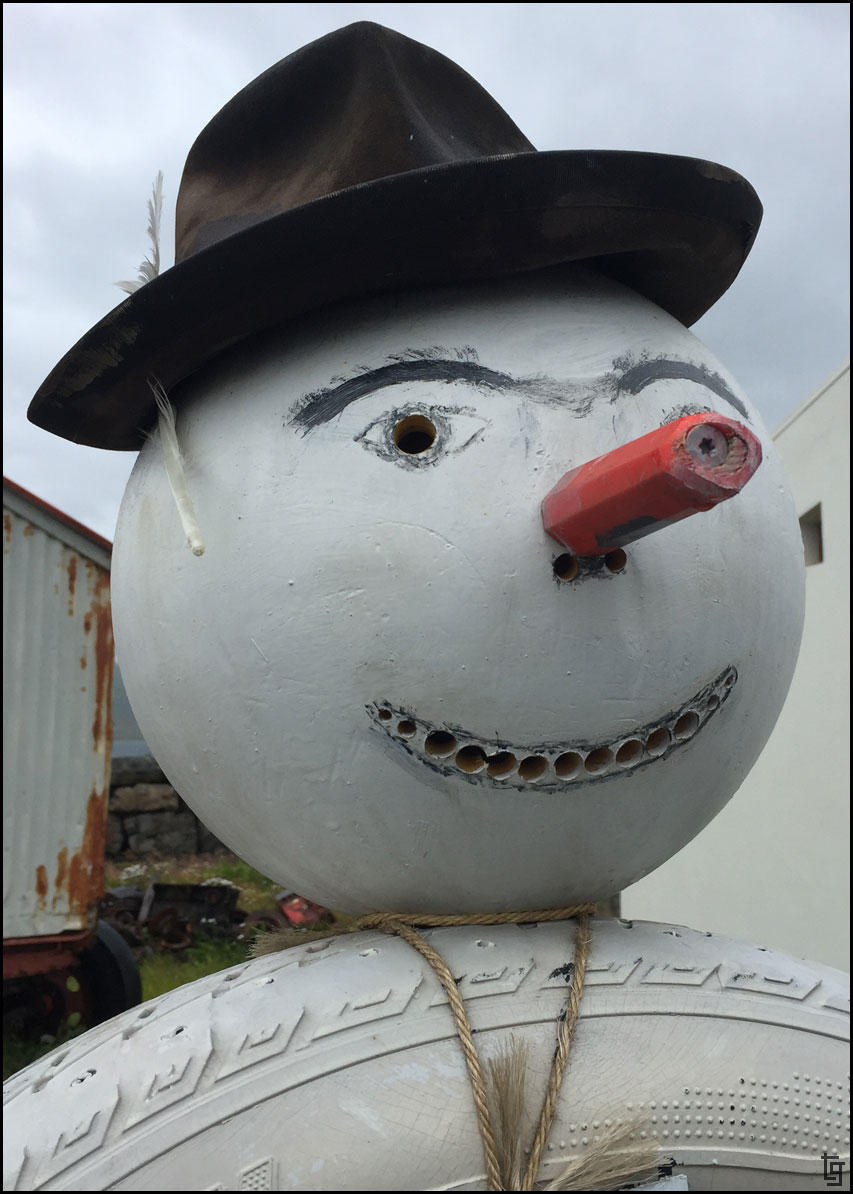
Roadside tire guy with a slightly different flair in Iceland.
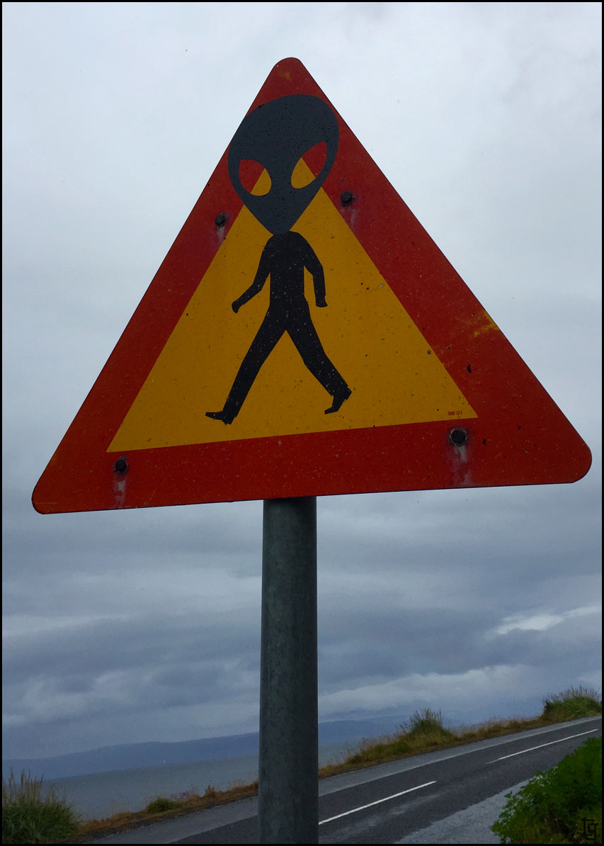
Alien cultures exist in Iceland as well; I though it was just Area 51 in Nevada.
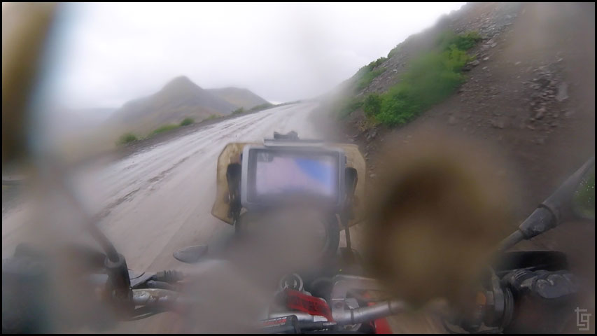
We continued south and the weather also got worse. It began to rain steadily and made the dirt section of the Vestfjarðavegur (Road 60) from Þingeyri really muddy.
Cars and SUVs would pass by and spray us in showers of muddy water.
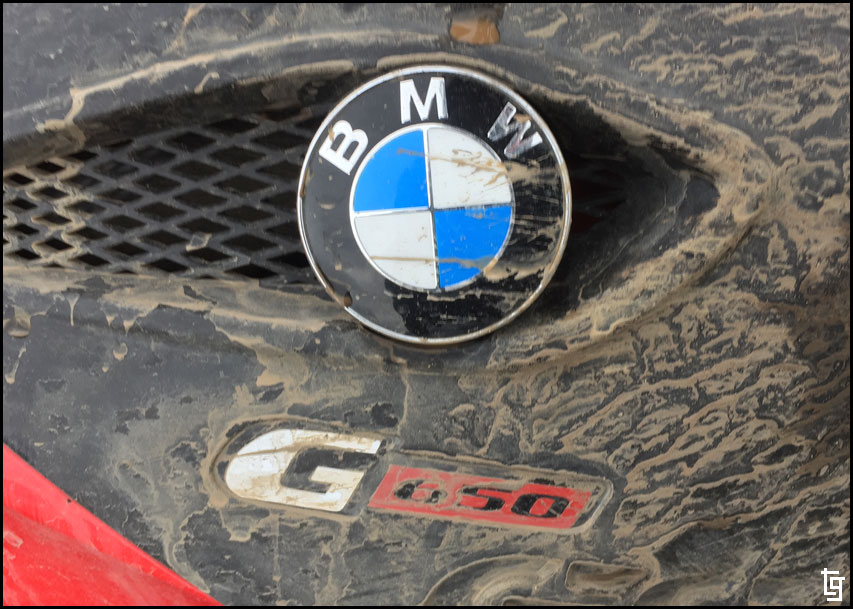
Our mules and us were soon covered in mud.
Even doing our best to avoid the mud puddles, the bikes (and pilots) were covered in a thin coat of watery mud.
Despite the weather, I still stopped to capture memories of the incredible scenery.
I would have been miserable however the scenery around us was absolutely incredible; these two mountain passes were some of my favorites.
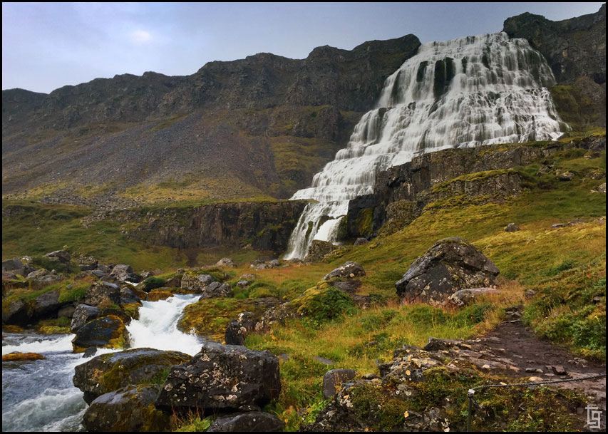
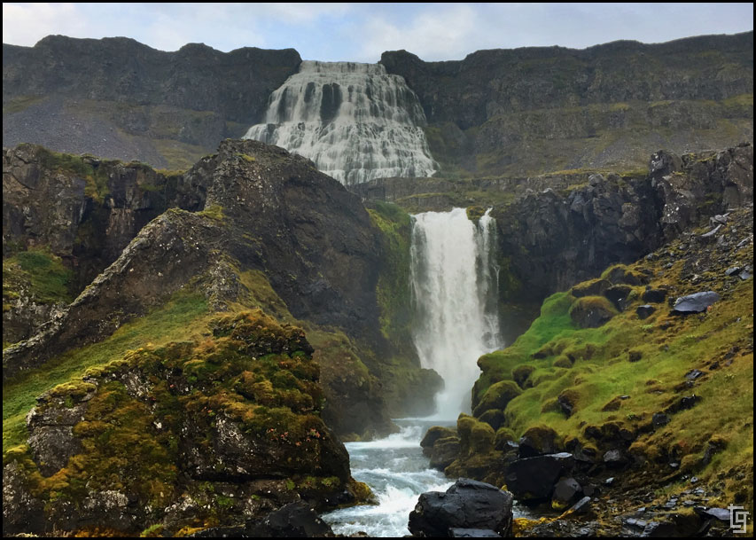
In the evening we made our way to Dynjandi falls. This is a massive falls than can be seen for miles away. The hike up to the base of the falls was beautiful and offered tons of picture opportunities. An incredible place without many tourists.
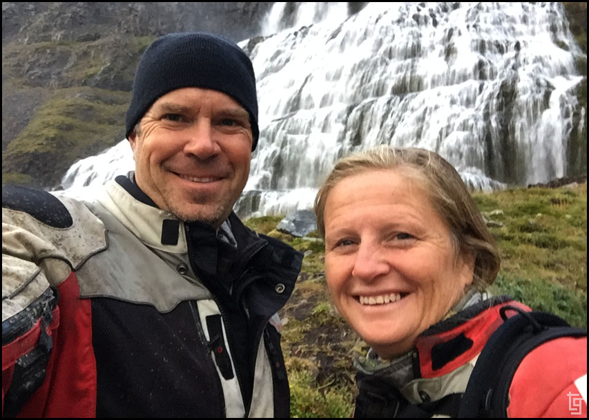
One of our favorite selfies of the trip. Still smiling.
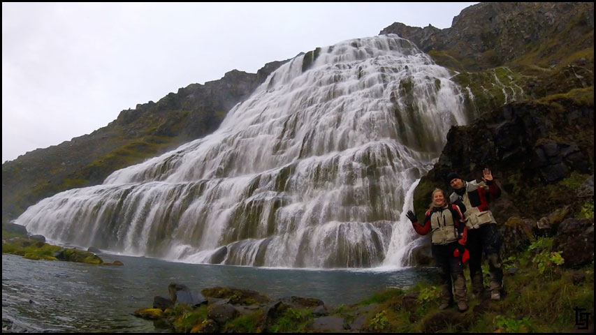
The Dynjandi falls are so large that we needed the GoPro to capture the entire falls.
We decided that we could make it into the town of Bíldudalur but it would be well past dark before we arrived. We were really looking forward to a great night of sleep and the chance to wash and dry all of our clothes.
It was 10:30 PM when we made it to the Harbour Inn Guesthouse. The problem is I couldn't figure out where to park and find the hotel attendant. As we were riding around the block a guy pulled up in his Nissan truck and asked if we were looking for a place to stay. Sure enough, he is the hotel owner and saw us riding around and thought we might need a room. He showed us a nice place with a double bed and said that we could use the laundry downstairs. Sold. We ended up doing laundry until after midnight but is was well worth having dry clothes.
Little did we know how short those clothes would stay dry. Tomorrow promises to be another wet day...
Day 7 - Sat, 26 Aug 17:Map of Day 7
It was a blessing to have the A-frame shelter last night. In the sleeping loft were some mattresses that when combined with our air mattress pads and sleeping bags made for a great night of sleep. I really didn't want to get up in the morning but we still had some places to explore so off we went.
Our first stop was to a roadside restaurant and museum.
The service was nice and the hot chocolate and waffles were exactly what we needed to continue our day of adventure.
Our next stop was in Ísafjarðarbær to top off our groceries of mostly kinder chocolates
Orange lighthouse makes for a short picture spot.
Abstract memory of the lighthouse.
The rain is already starting with the forecast calling for heavy rain all day.
A bit past town we arrived at the Mariners Museum but it was closed. Since much of the displays were outdoors we still got to explore and take some pictures.
Another tunnel making access between the small villages easier.
We returned to Ísafjarðarbær where we gassed up the mules and we tried our first SS Icelandic hotdog - apparently world famous.
Bacon wrapped hotdog inside a toasted bun that looks like it was stepped on by a work boot. How was it? Mostly anything wrapped in bacon is delicious - so yea, it was good. Not great.
Roadside tire guy with a slightly different flair in Iceland.
Alien cultures exist in Iceland as well; I though it was just Area 51 in Nevada.
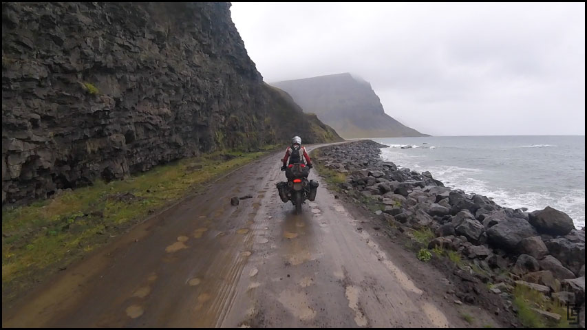
We continued south and the weather also got worse. It began to rain steadily and made the dirt section of the Vestfjarðavegur (Road 60) from Þingeyri really muddy.
Cars and SUVs would pass by and spray us in showers of muddy water.
Our mules and us were soon covered in mud.
Even doing our best to avoid the mud puddles, the bikes (and pilots) were covered in a thin coat of watery mud.
Despite the weather, I still stopped to capture memories of the incredible scenery.
I would have been miserable however the scenery around us was absolutely incredible; these two mountain passes were some of my favorites.
In the evening we made our way to Dynjandi falls. This is a massive falls than can be seen for miles away. The hike up to the base of the falls was beautiful and offered tons of picture opportunities. An incredible place without many tourists.
One of our favorite selfies of the trip. Still smiling.
The Dynjandi falls are so large that we needed the GoPro to capture the entire falls.
We decided that we could make it into the town of Bíldudalur but it would be well past dark before we arrived. We were really looking forward to a great night of sleep and the chance to wash and dry all of our clothes.
It was 10:30 PM when we made it to the Harbour Inn Guesthouse. The problem is I couldn't figure out where to park and find the hotel attendant. As we were riding around the block a guy pulled up in his Nissan truck and asked if we were looking for a place to stay. Sure enough, he is the hotel owner and saw us riding around and thought we might need a room. He showed us a nice place with a double bed and said that we could use the laundry downstairs. Sold. We ended up doing laundry until after midnight but is was well worth having dry clothes.
Little did we know how short those clothes would stay dry. Tomorrow promises to be another wet day...
-
TravisGill
- Posts: 125
- Joined: Tue Apr 10, 2018 10:09 am
- Location: Germany
- Has thanked: 57 times
- Been thanked: 172 times
Re: Iceland and Faroe Islands - Bridge Between Continents...
Iceland Day 8 - Sun, 27 Aug 17:
Map of Day 8
Today's forecast shows more rain and winds. At least the temperature is not too cold - 50°F.
We got up late and enjoyed a breakfast provided by the hotel. The hotel did a great job of making us feel at home and had a lot of food options for a continental breakfast.
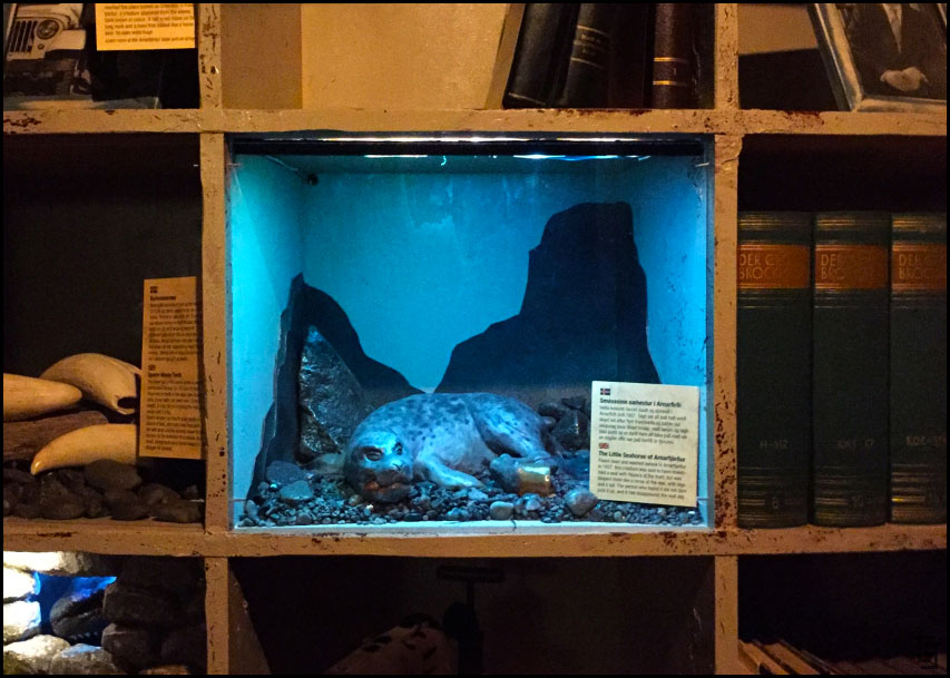
After breakfast we walked over to the Sea-monster Museum. It was small and the front desk lady was not very welcoming but the displays were professionally designed including the great lighting. It was interesting to learn about the stories of sea-monsters that had been recorded by those who witnessed them.
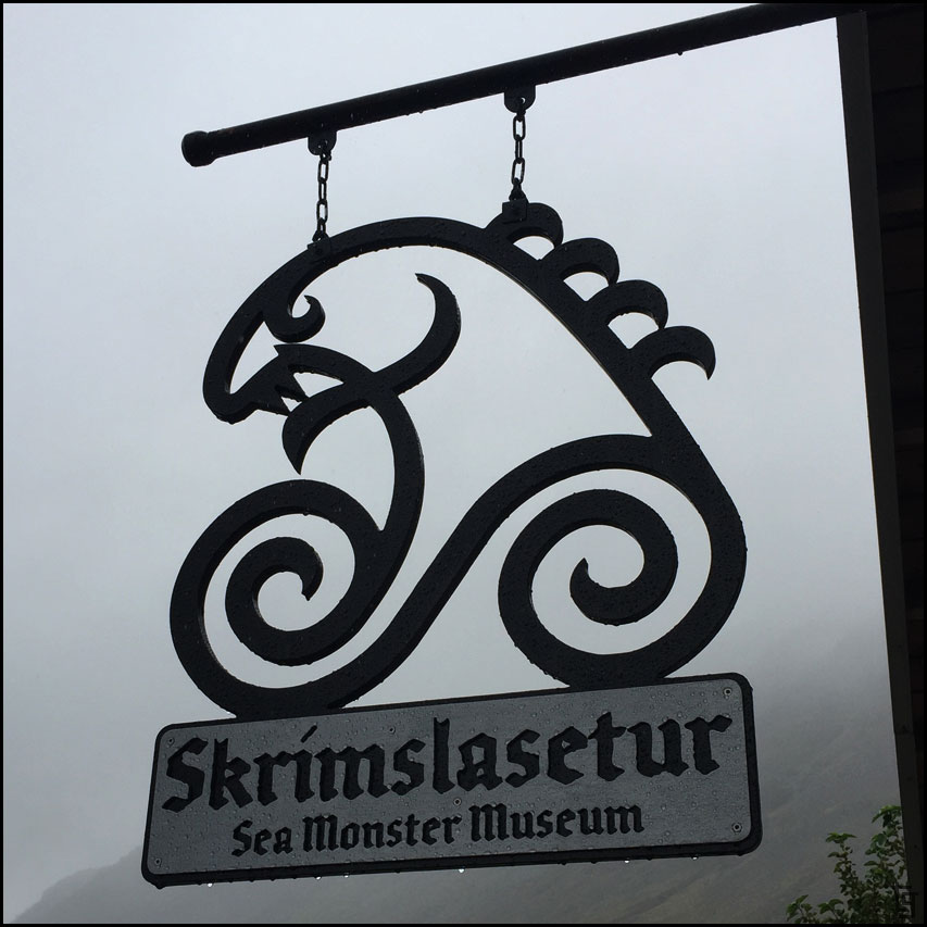
Cold and rainy day - a good day for checking out sea-monsters.
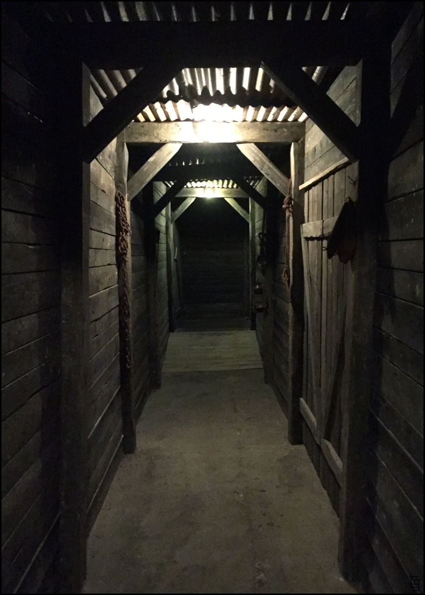
The entrance to the museum. Although small the museum did a good job displaying the various sea-monster sightings.
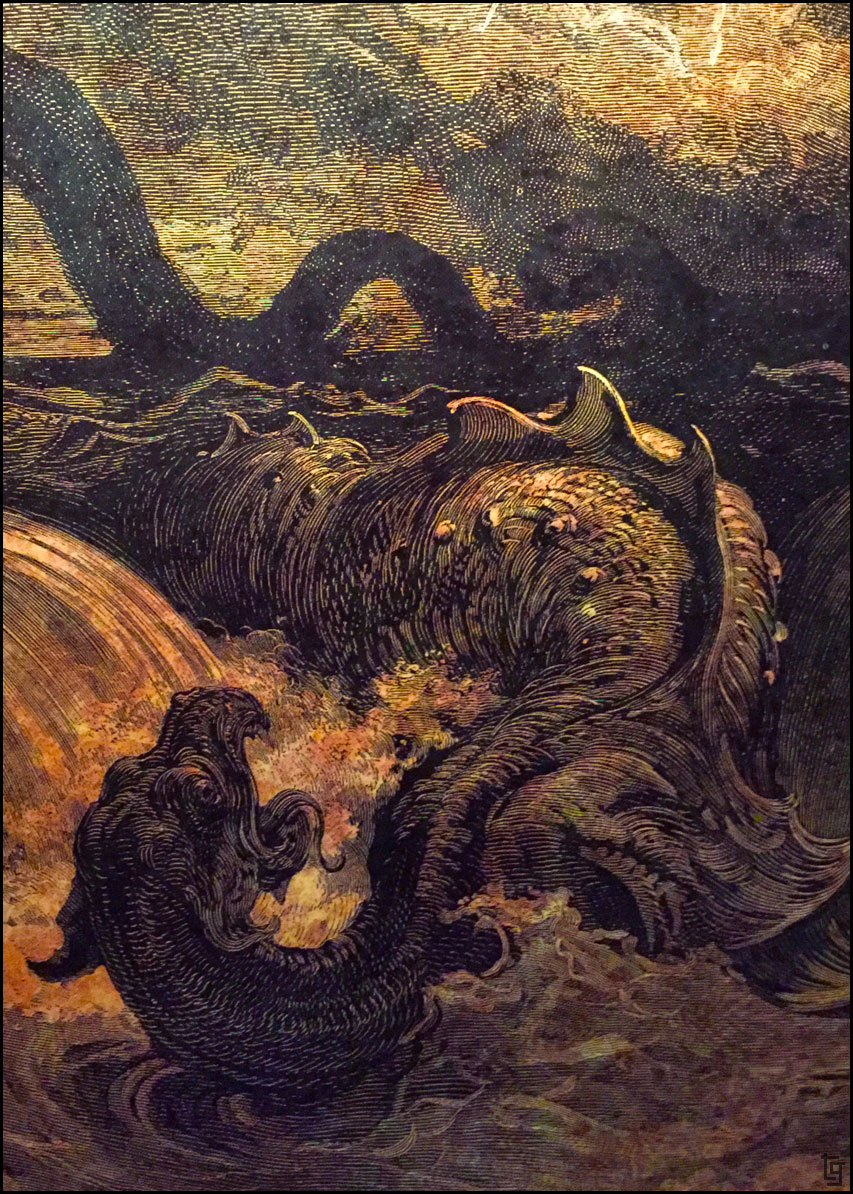
Just some of the monsters that were sighted in the cold waters of the Atlantic.
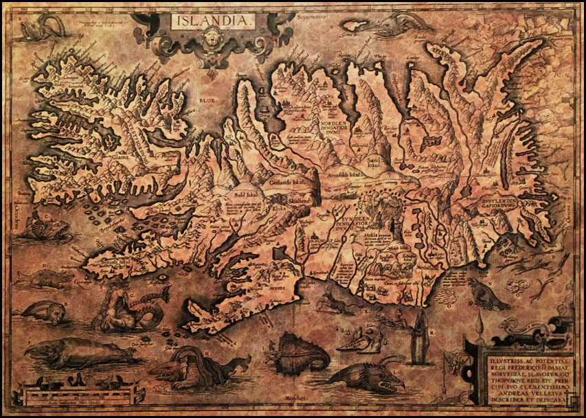
Old map of Islandia.
The extensive library of stories and sightings.
The rain was coming down thicker as we prepared the bikes for the next 12 miles of muddy road towards Samúel Jónsson’s Art Farm.
The ride out there was beautiful but wet and dirty. Once we arrived we were soaked.
The rain let up enough for me to take some pictures of this unique world created by Jónsson.
Samúel Jónsson’s made this church to house his artwork.
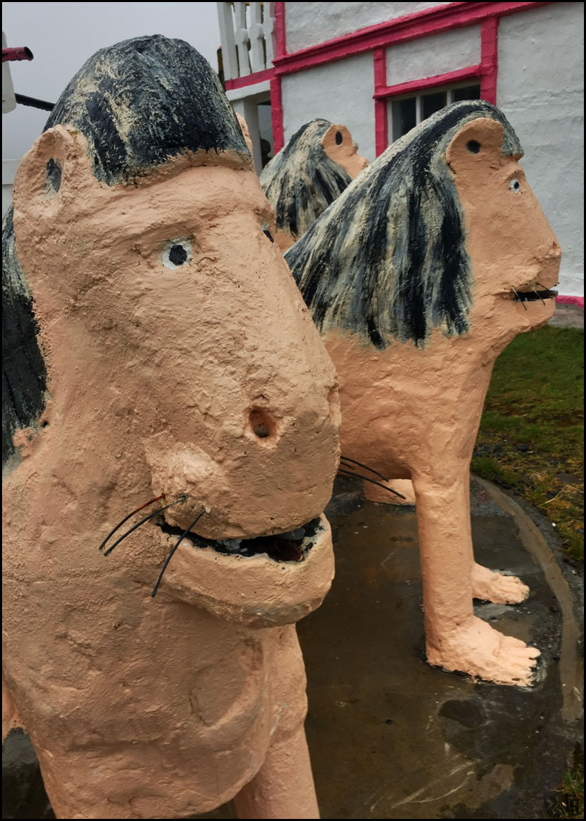
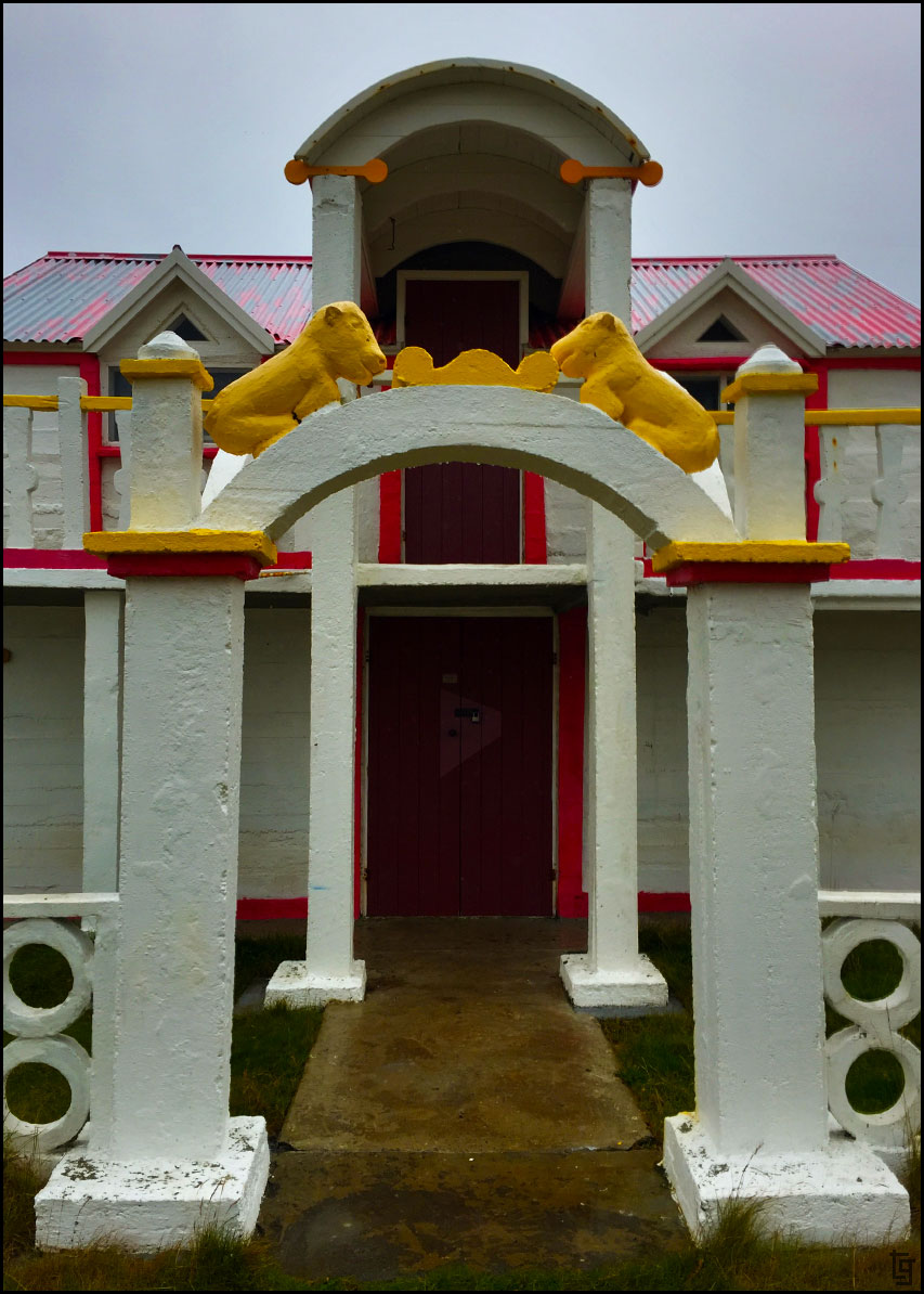
A replica of the The Patio de los Leones (Court of the Lions) located in Granada, Spain.
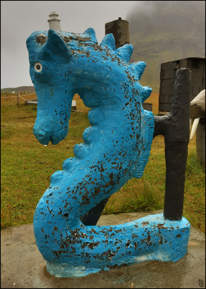
I think my favorite was the blue seahorse.
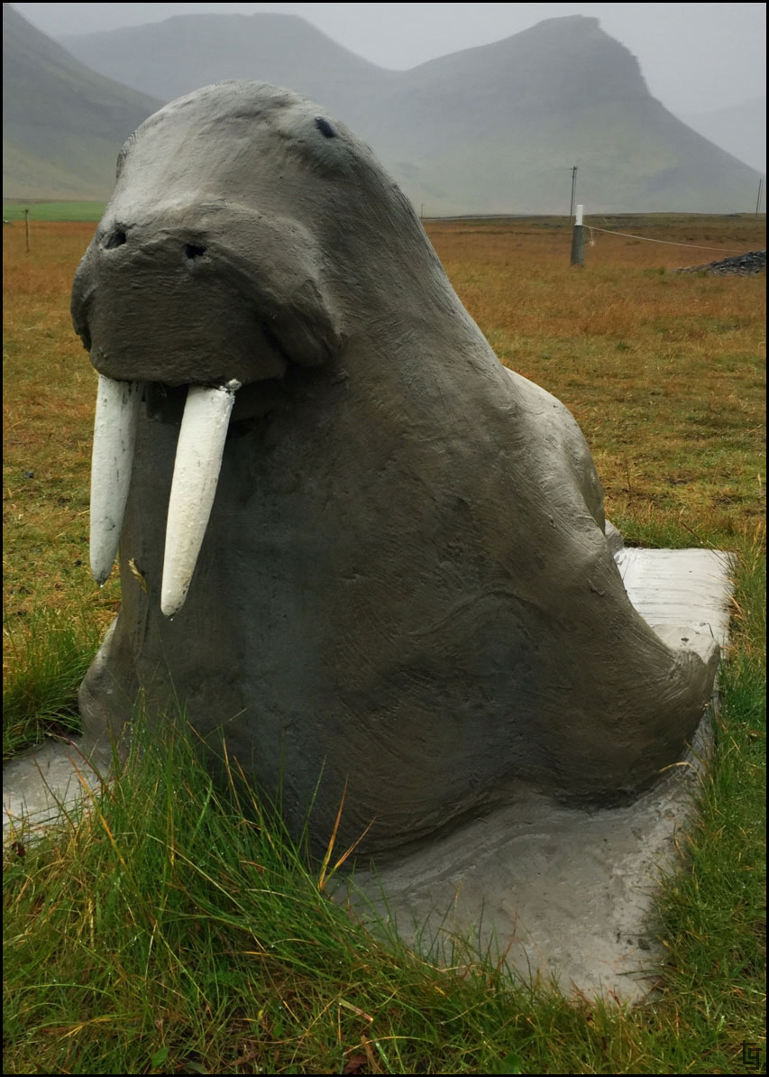
No wait... I think my favorite is the gray walrus.
The replica of the Indian temple.
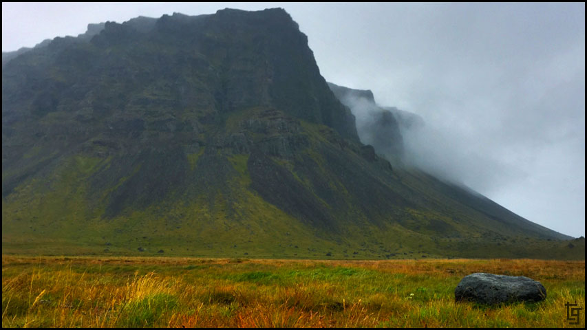
A quite farm next to the ocean.
Exploring the incredible valley a bit more before heading back towards town.
Even if your not into the child-inspired art of Samúel Jónsson’s, the road out to his farm is worth the diversion.
We returned to Bíldudalur to wash off the bikes enough that we wouldn't be getting muddier every time we needed to get something from the packs.
Leaving the Fjords behind we climbed the high mountain passes where we felt the worst of the rain and wind. It was blowing us around the road and the visibility was reduced to about 100 ft. We made slow progress through the mountains.
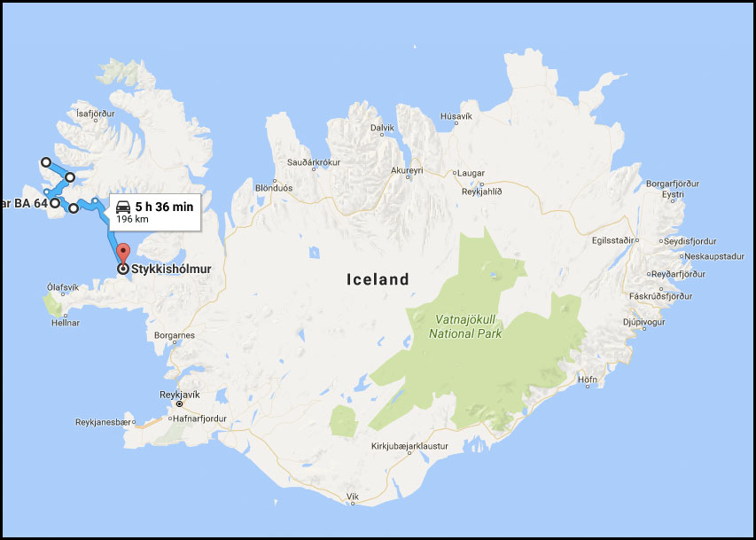
Our goal was to make it to Látrabjarg where the cliffs rise from the sea and hopefully catch a sight of a puffin, but with the poor weather we decided to ride to catch the Stykkishólmur ferry.
We still had a few more sights to see first...
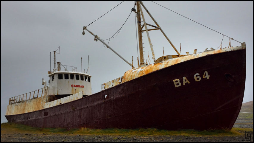
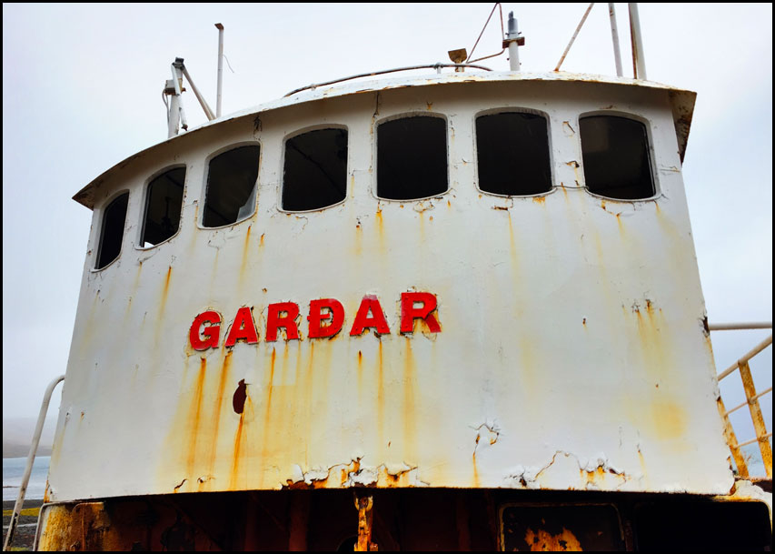
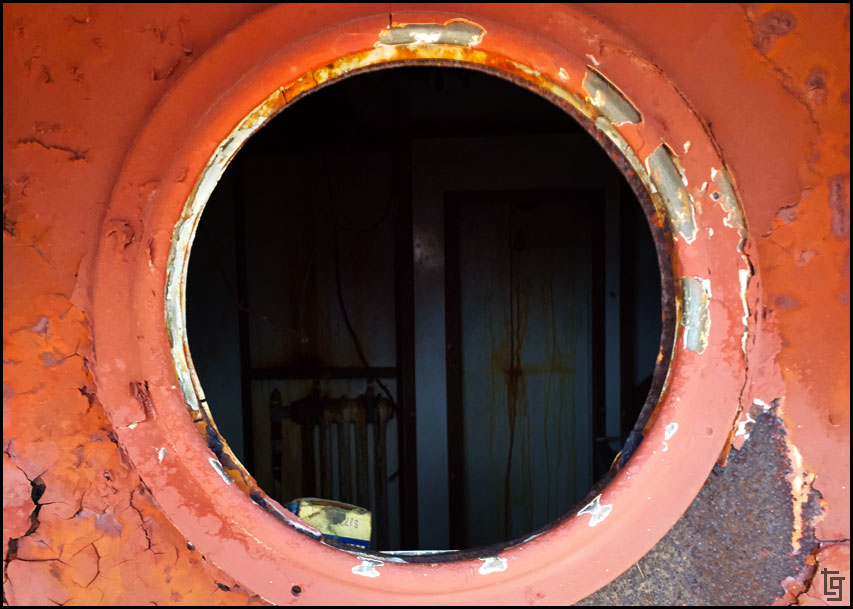
Garðar BA 64 was used or fishing herring in the waters off of Iceland until is was intentionally ran aground in 1981.
While riding towards the ferry I noticed a hot pool on my GPS so we took a quick detour to enjoy it. It turns out that the bathroom at the hot pools were all locked. Was is closed? The pool and hot tub were open but there was nobody around. We decided we were already wet and cold, why not at least be wet and warm?
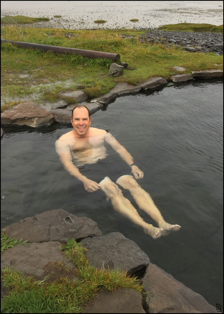
It seems that if you want a hot tub to yourself in Iceland you just have to wait until the weather turns terrible.
Although the hot pool was an enjoyable experience - getting out and changing back into our wet gear was not. Once on the bikes, each mile felt like a challenge and I was starting to curse the weather. Perhaps, we should re-evaluate our rain liners that snap inside the jacket and pants. Maybe rain gear that we wear outside our riding gear would be better?
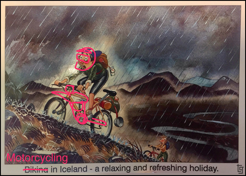
We found this postcard a few days later and made some digital alterations. This is about right and was my exactly feelings during this particular day.
We managed to ride another 15 miles to the ferry terminal and payed the very expensive rate of about $170 USD to ferry us and our two bikes to Stykkishólmu. It was either that our continue another three or more hours riding in the rain. Gotta wonder if some $50 USD raingear would have saved us the misery and cost?
We were grateful that the ferry terminal was warm inside and that they had hot food. We enjoyed a couple grilled ham and cheese sandwiches while we waited to the ferry to arrive and dock.
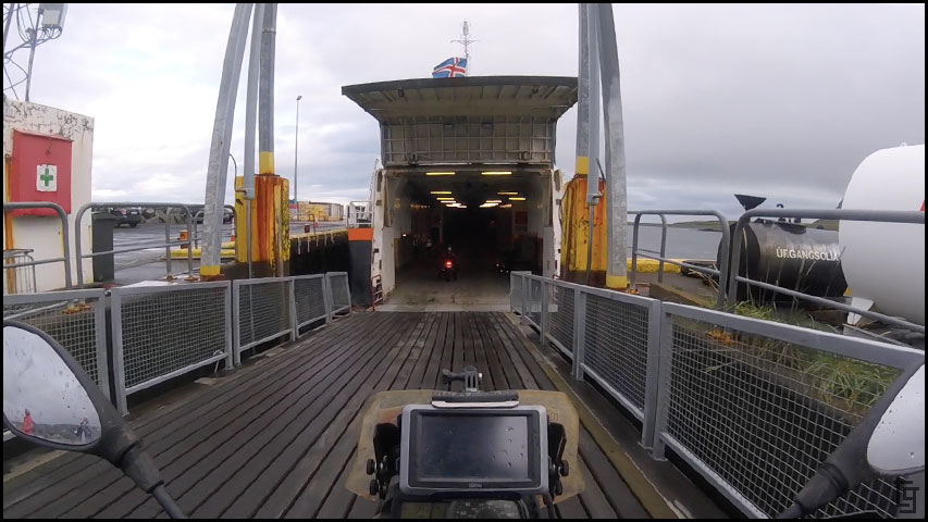
Riding the bikes onto the ferry.
The ferry crew gave us one strap per bike and showed where the screwdrivers were to pull up the rusted pad-eyes. Not much help. Fortunately we carry a bag of straps for each bike and managed to get them secure before the ferry got underway.
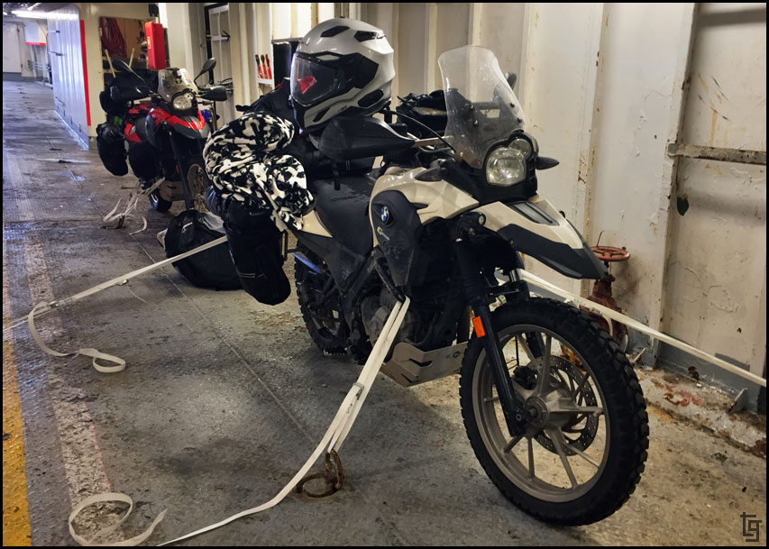
Mules strapped up for their journey to Stykkishólmur.
The three-hour ferry ride gave us a chance to dry off most of our riding and camping gear with towels and a heater from the bathrooms.
Just before 10PM we arrived in Stykkishólmur and rode over to the camp site. Great news; they had a clothes dryer that we could use! We ended up drying clothes well until after midnight.
Tomorrow morning looks like more rain... Not looking forward to that.
Day 8 - Sun, 27 Aug 17:Map of Day 8
Today's forecast shows more rain and winds. At least the temperature is not too cold - 50°F.
We got up late and enjoyed a breakfast provided by the hotel. The hotel did a great job of making us feel at home and had a lot of food options for a continental breakfast.
After breakfast we walked over to the Sea-monster Museum. It was small and the front desk lady was not very welcoming but the displays were professionally designed including the great lighting. It was interesting to learn about the stories of sea-monsters that had been recorded by those who witnessed them.
Cold and rainy day - a good day for checking out sea-monsters.
The entrance to the museum. Although small the museum did a good job displaying the various sea-monster sightings.
Just some of the monsters that were sighted in the cold waters of the Atlantic.
Old map of Islandia.
The extensive library of stories and sightings.
The rain was coming down thicker as we prepared the bikes for the next 12 miles of muddy road towards Samúel Jónsson’s Art Farm.
The ride out there was beautiful but wet and dirty. Once we arrived we were soaked.
The rain let up enough for me to take some pictures of this unique world created by Jónsson.
Samúel Jónsson’s made this church to house his artwork.
A replica of the The Patio de los Leones (Court of the Lions) located in Granada, Spain.
I think my favorite was the blue seahorse.
No wait... I think my favorite is the gray walrus.
The replica of the Indian temple.
A quite farm next to the ocean.
Exploring the incredible valley a bit more before heading back towards town.
Even if your not into the child-inspired art of Samúel Jónsson’s, the road out to his farm is worth the diversion.
We returned to Bíldudalur to wash off the bikes enough that we wouldn't be getting muddier every time we needed to get something from the packs.
Leaving the Fjords behind we climbed the high mountain passes where we felt the worst of the rain and wind. It was blowing us around the road and the visibility was reduced to about 100 ft. We made slow progress through the mountains.
Our goal was to make it to Látrabjarg where the cliffs rise from the sea and hopefully catch a sight of a puffin, but with the poor weather we decided to ride to catch the Stykkishólmur ferry.
We still had a few more sights to see first...
Garðar BA 64 was used or fishing herring in the waters off of Iceland until is was intentionally ran aground in 1981.
While riding towards the ferry I noticed a hot pool on my GPS so we took a quick detour to enjoy it. It turns out that the bathroom at the hot pools were all locked. Was is closed? The pool and hot tub were open but there was nobody around. We decided we were already wet and cold, why not at least be wet and warm?
It seems that if you want a hot tub to yourself in Iceland you just have to wait until the weather turns terrible.
Although the hot pool was an enjoyable experience - getting out and changing back into our wet gear was not. Once on the bikes, each mile felt like a challenge and I was starting to curse the weather. Perhaps, we should re-evaluate our rain liners that snap inside the jacket and pants. Maybe rain gear that we wear outside our riding gear would be better?
We found this postcard a few days later and made some digital alterations. This is about right and was my exactly feelings during this particular day.
We managed to ride another 15 miles to the ferry terminal and payed the very expensive rate of about $170 USD to ferry us and our two bikes to Stykkishólmu. It was either that our continue another three or more hours riding in the rain. Gotta wonder if some $50 USD raingear would have saved us the misery and cost?
We were grateful that the ferry terminal was warm inside and that they had hot food. We enjoyed a couple grilled ham and cheese sandwiches while we waited to the ferry to arrive and dock.
Riding the bikes onto the ferry.
The ferry crew gave us one strap per bike and showed where the screwdrivers were to pull up the rusted pad-eyes. Not much help. Fortunately we carry a bag of straps for each bike and managed to get them secure before the ferry got underway.
Mules strapped up for their journey to Stykkishólmur.
The three-hour ferry ride gave us a chance to dry off most of our riding and camping gear with towels and a heater from the bathrooms.
Just before 10PM we arrived in Stykkishólmur and rode over to the camp site. Great news; they had a clothes dryer that we could use! We ended up drying clothes well until after midnight.
Tomorrow morning looks like more rain... Not looking forward to that.
-
TravisGill
- Posts: 125
- Joined: Tue Apr 10, 2018 10:09 am
- Location: Germany
- Has thanked: 57 times
- Been thanked: 172 times
Re: Iceland and Faroe Islands - Bridge Between Continents...
Iceland Day 9 - Mon, 28 Aug 17:
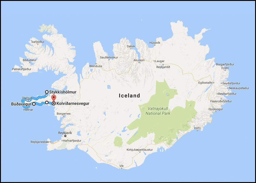
Map of Day 9 covering the Snæfellsnes Peninsula.
What a difference one day can make!! Yesterday I was ready to park ourselves in a hotel until the rain ended. Today we experienced beautiful weather for most of the day...
We woke up late again - partly due to being up till after midnight, and partly due to hearing little rain drops on the tent every time we woke up. It was well after 10:30 that the rain stopped enough to take down all our sleeping gear and tent. We left the camp at about 11:30. The first stop was a bakery where we enjoyed brunch.
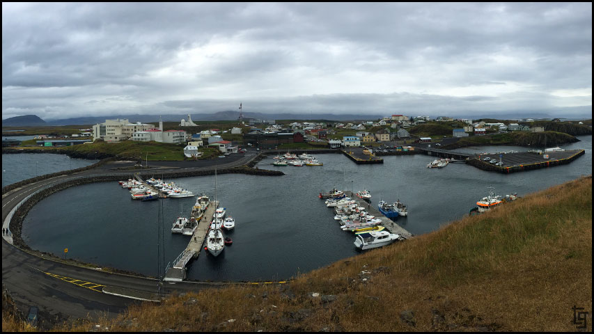
We explored the seaside town of Stykkishólmur...
... and the lighthouse, before hitting the road towards the west.
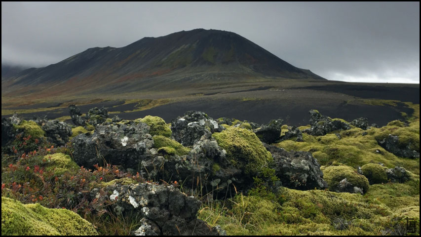
This part of Iceland is very lush and volcanic so the lush green moss grows thick over black lava rocks.
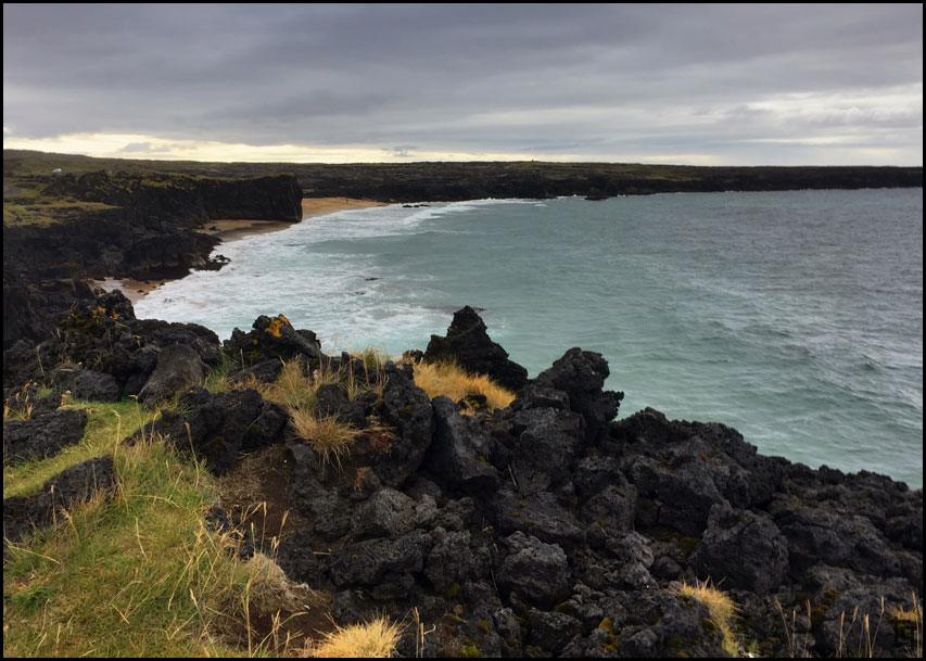
It was an incredible ride to the Snaefellsjoekull National Park where we enjoyed some hiking down to a few beaches.
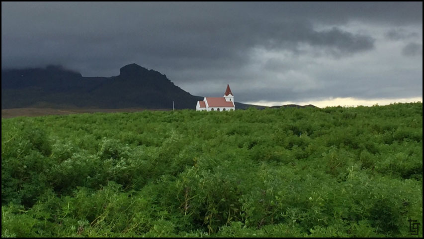
A beautiful church in a sea of green.
Snaefellsjoekull National Park was full of beautiful scenery at nearly every turn.
Skarðsvík Beach
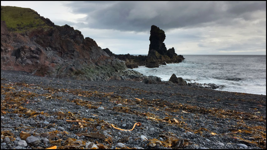
The hike down to Djúpalónssandur beach.
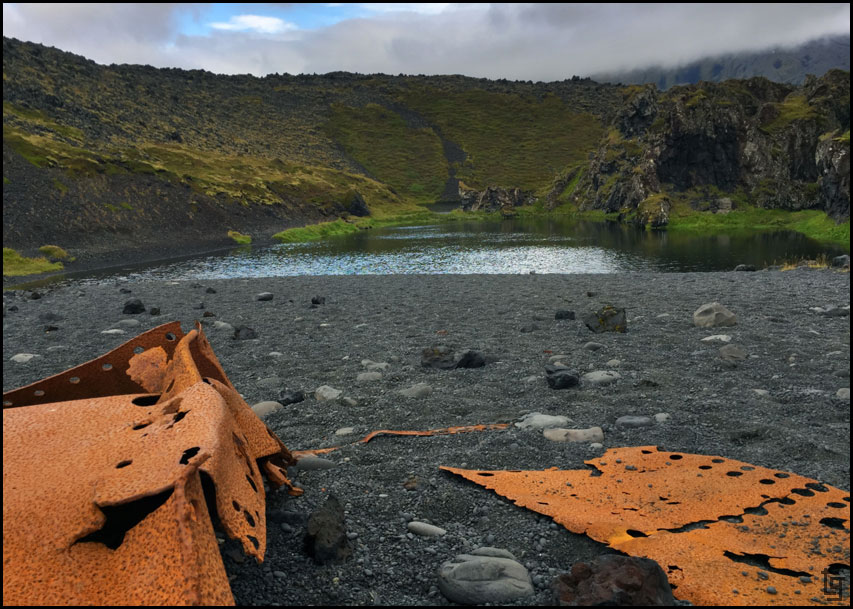
Rusted pieces of the British trawler, The Epine GY7, which was wrecked east of Dritvík cove on the night of 13 March 1948 still remain on the black beach.
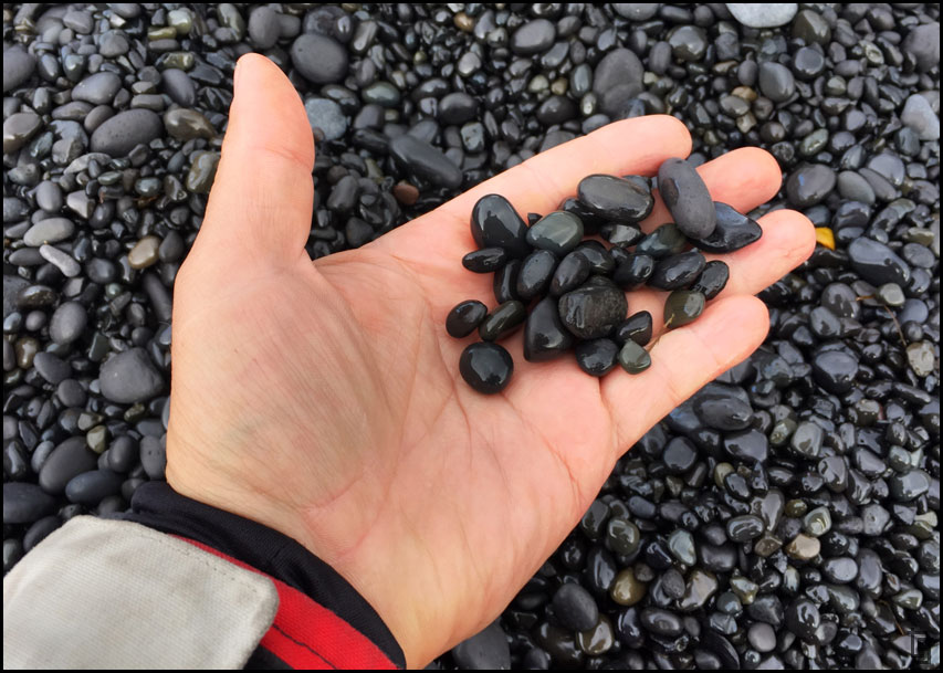
Black lava rocks made smooth by the churning of the ocean waves.
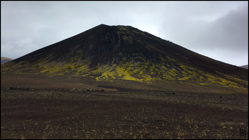
The volcanic geology of Iceland.
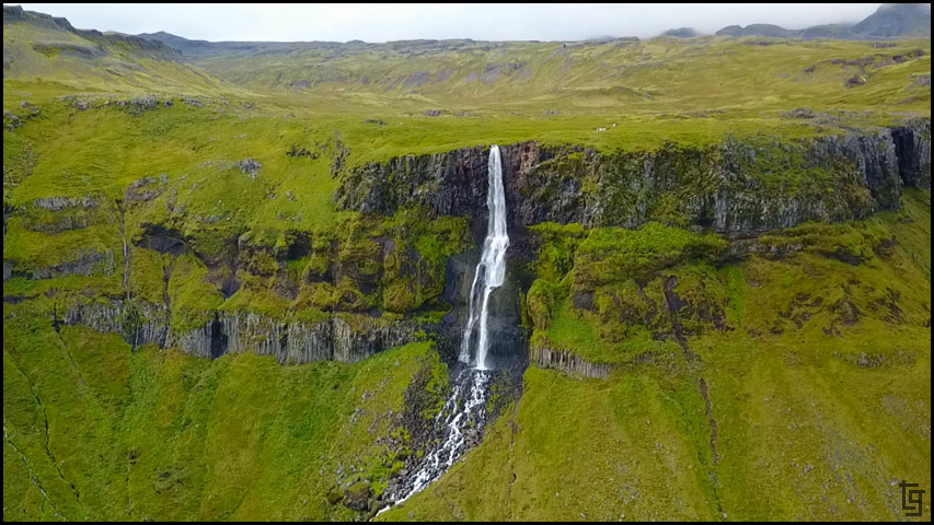
One of the best shots was of a waterfall called Bjarnarfoss located on the Snæfellsnes Peninsula.
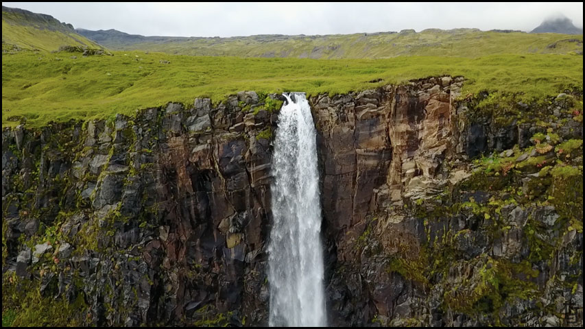
This waterfall sits high on a cliff face and without the drone you wouldn't be able to get close enough to see the detail.
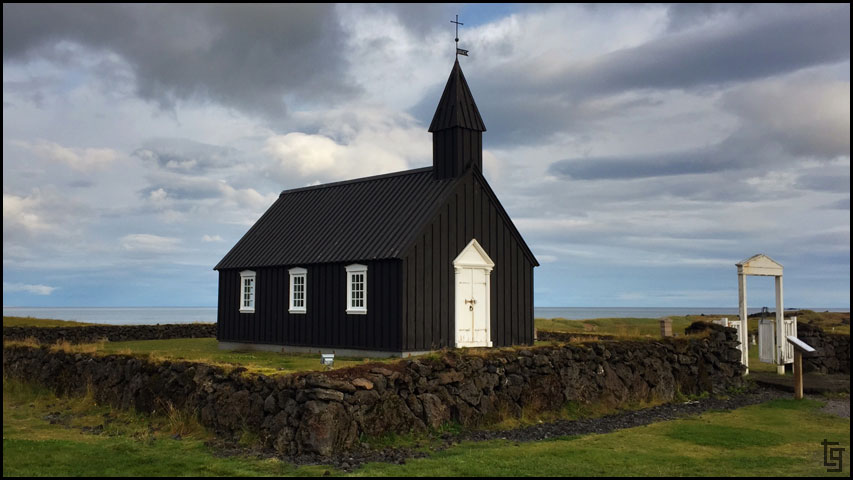
After the falls we stopped to take some pictures of the famous black colored church in Buðir. It's a beautiful church that sits alone in a lava field.
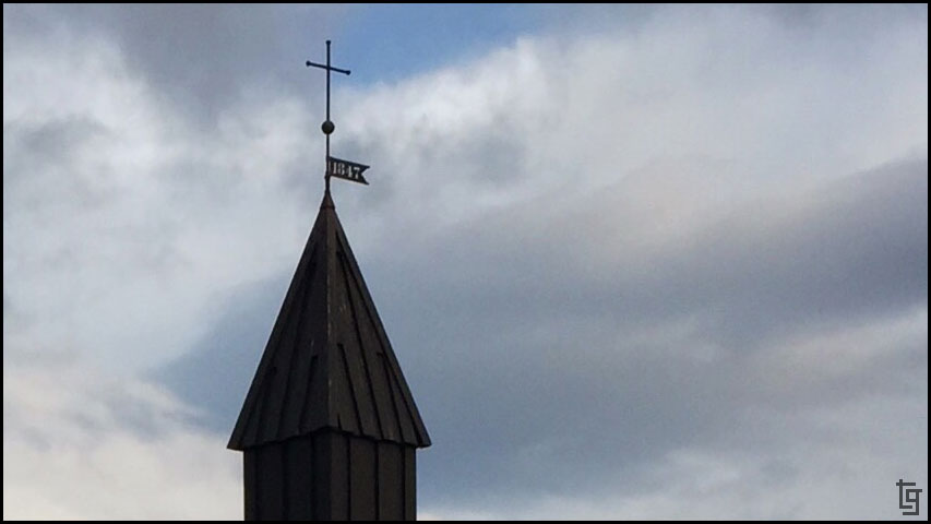
Búðakirkja steeple
It was starting to get into the evening and we needed gas. The GPS showed gas at Rjúkanda restaurant but it turned out there was no gas. I'm actually glad that the GPS was wrong because we discovered a great place to eat dinner. Rjúkanda restaurant was also a favorite because I got to try something I've wanted to eat since arriving in Iceland - fillet of foal. Yes, you read correct... Horse meat. How did it taste? Much like a beef streak but with just a bit different taste. I thought it was really good!
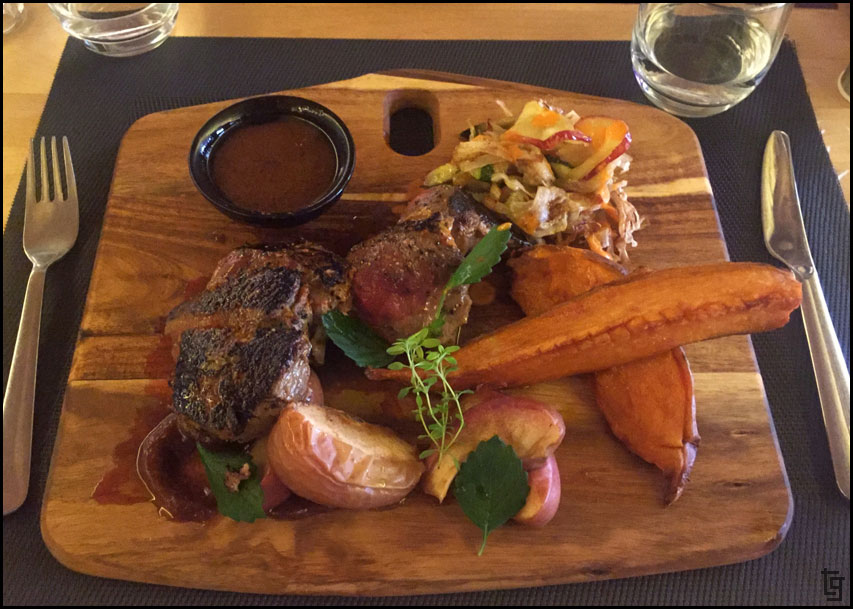
Horse meat - "it's what's for dinner"
After dinner it was near dark so we searched on the map for the closest camping spot. Great news! - There was one only a few miles down the road. Bad news - It's not there any longer. We ended up searching for the place well until after 10PM before we finally settled on a flat area concealed behind a small hill just off of the side road. Good enough.
Until tomorrow...
Day 9 - Mon, 28 Aug 17:Map of Day 9 covering the Snæfellsnes Peninsula.
What a difference one day can make!! Yesterday I was ready to park ourselves in a hotel until the rain ended. Today we experienced beautiful weather for most of the day...
We woke up late again - partly due to being up till after midnight, and partly due to hearing little rain drops on the tent every time we woke up. It was well after 10:30 that the rain stopped enough to take down all our sleeping gear and tent. We left the camp at about 11:30. The first stop was a bakery where we enjoyed brunch.
We explored the seaside town of Stykkishólmur...
... and the lighthouse, before hitting the road towards the west.
This part of Iceland is very lush and volcanic so the lush green moss grows thick over black lava rocks.
It was an incredible ride to the Snaefellsjoekull National Park where we enjoyed some hiking down to a few beaches.
A beautiful church in a sea of green.
Snaefellsjoekull National Park was full of beautiful scenery at nearly every turn.
Skarðsvík Beach
The hike down to Djúpalónssandur beach.
Rusted pieces of the British trawler, The Epine GY7, which was wrecked east of Dritvík cove on the night of 13 March 1948 still remain on the black beach.
Black lava rocks made smooth by the churning of the ocean waves.
The volcanic geology of Iceland.
One of the best shots was of a waterfall called Bjarnarfoss located on the Snæfellsnes Peninsula.
This waterfall sits high on a cliff face and without the drone you wouldn't be able to get close enough to see the detail.
After the falls we stopped to take some pictures of the famous black colored church in Buðir. It's a beautiful church that sits alone in a lava field.
Búðakirkja steeple
It was starting to get into the evening and we needed gas. The GPS showed gas at Rjúkanda restaurant but it turned out there was no gas. I'm actually glad that the GPS was wrong because we discovered a great place to eat dinner. Rjúkanda restaurant was also a favorite because I got to try something I've wanted to eat since arriving in Iceland - fillet of foal. Yes, you read correct... Horse meat. How did it taste? Much like a beef streak but with just a bit different taste. I thought it was really good!
Horse meat - "it's what's for dinner"
After dinner it was near dark so we searched on the map for the closest camping spot. Great news! - There was one only a few miles down the road. Bad news - It's not there any longer. We ended up searching for the place well until after 10PM before we finally settled on a flat area concealed behind a small hill just off of the side road. Good enough.
Until tomorrow...
-
TravisGill
- Posts: 125
- Joined: Tue Apr 10, 2018 10:09 am
- Location: Germany
- Has thanked: 57 times
- Been thanked: 172 times
Re: Iceland and Faroe Islands - Bridge Between Continents...
Iceland Day 10: Tue, 29 Aug 17:
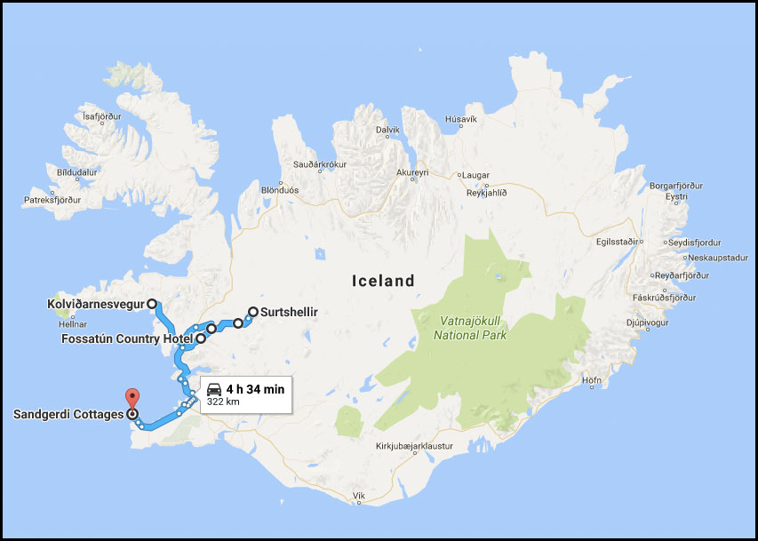
Map of Day 10
We got an early start, partly because we were camped just off the road and didn't want to arouse any more suspicion, and partly because we were excited for another day without rain.
Our first stop was Deildartunguhver hot springs but they were under a lot of construction making it difficult to see the boiling water coming from the depths of the Earth. The steam, on the other hand, was noticeable for miles around.
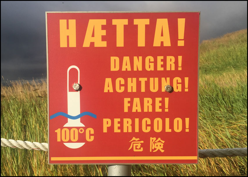
Hot stuff - in various languages.
As the morning progressed we realized that we were definitely within hours of the capital of Raykavik because the roads and tourist attractions were full of rentals and tour buses.
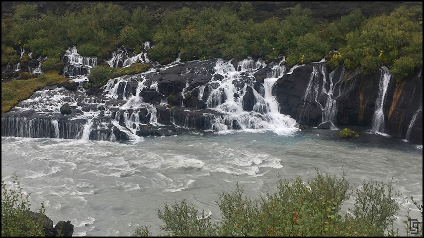
Our next stop of Barnafoss falls was not the most beautiful of Icelands falls but it did have a nice hike.
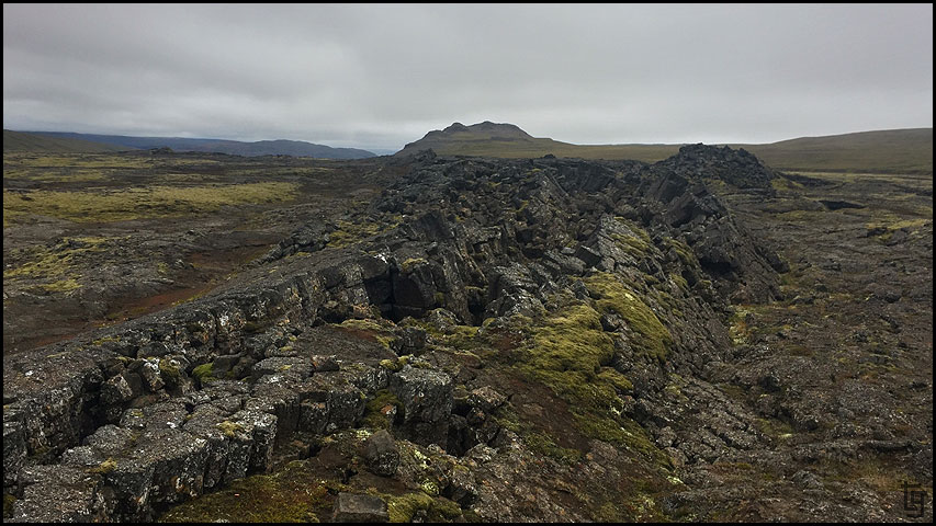
We wanted to explore a lava cave but many of them have become "touristized" and require a steep fee to have a guide walk you though. Not my thing; I'd rather explore at my own pace. Fortunately, for those adventurous enough there is Surtshellir cave. We parked well north of the parking area and walked south underground exploring each of the caves and entrances. The caves really are quite large some featured beautiful metallic looking stalactites.
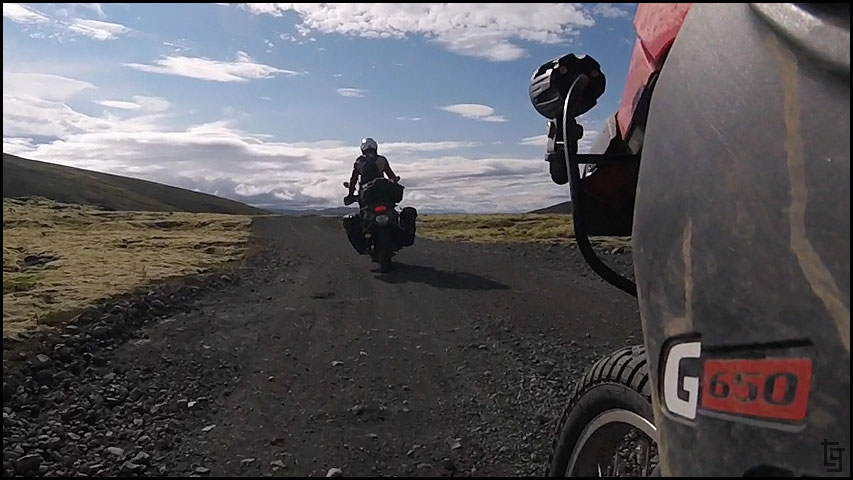
Heading to the Surtshellir cave via a well traveled dirt road.
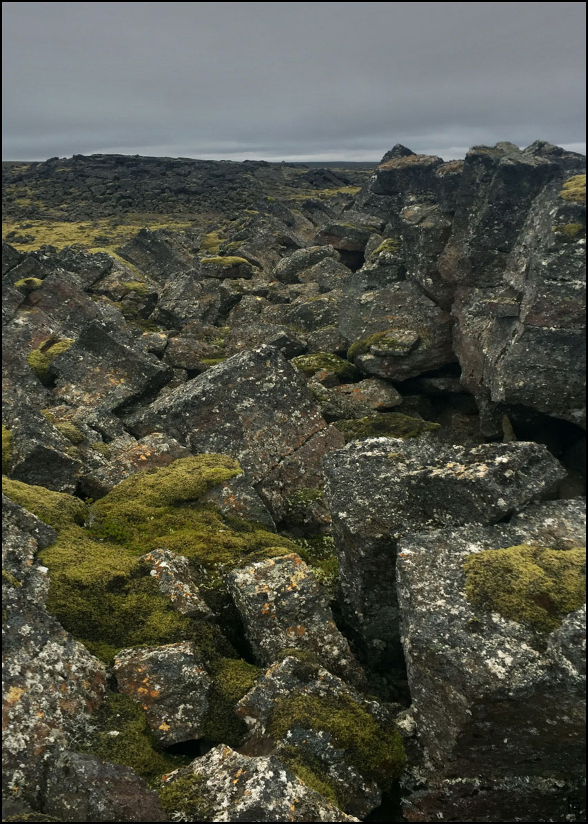
On our walk to the Surtshellir cave you see huge cube shaped rocks that were pushed upwards along the fault line.
The power of Mother Earth!
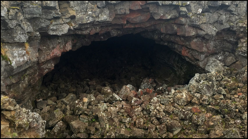
One of the cave entrances.
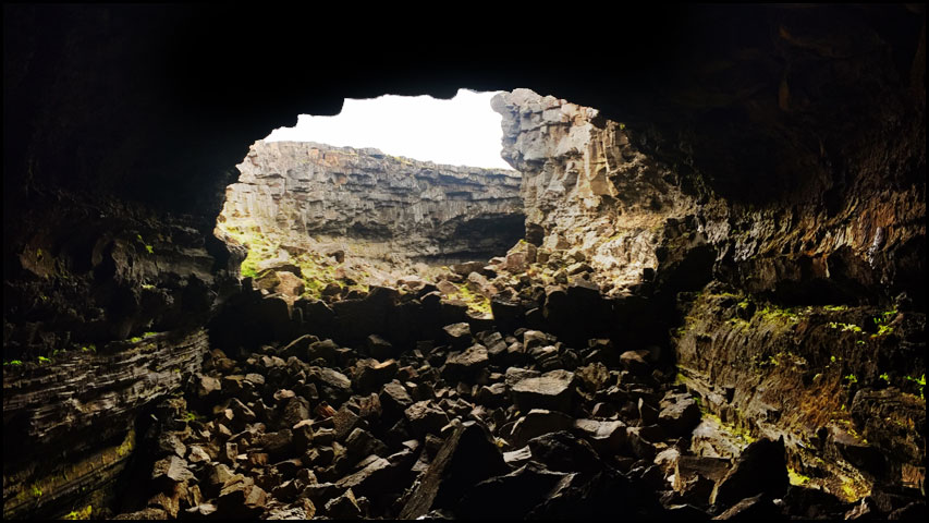
Inside it was cold and damp; kinda like you expect a cave to be. Once you were in the cave about 100 yards it was completely black.

This black. No kidding. Black so black you can't see anything. Not having a lamp would be death by a thousand tiny volcanic rock cuts.
Leaving in search of other sites...
On out way back from the caves we came across Fossatún Falls. This is a really relaxing area with a great walking trail that taught about trolls and the Icelandic folklore that surrounding them.
Tröllafossar or the Fall of the Trolls
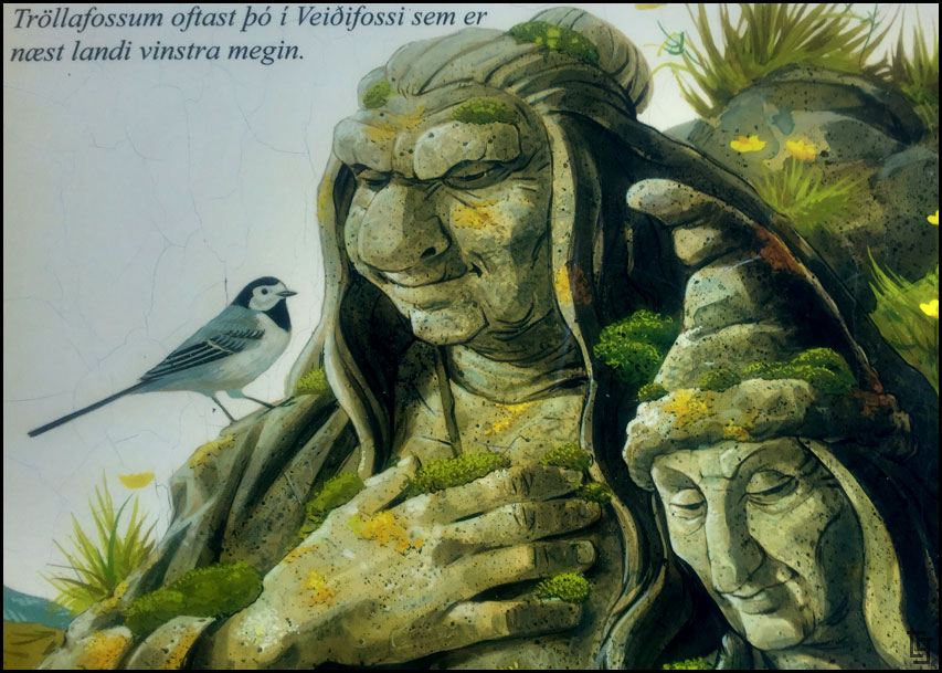
The trail has many displays with the artwork from Steinar Berg who has written three books on trolls and has erected several trolls from his stories.
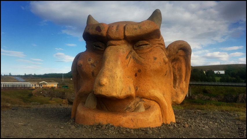
Troll head
This is Grýla, who is the mother of the Yulelads. She is not the nicest of the trolls because she eats naughty children and cooks them in her cauldron.
Maybe she's not so bad because she only cooks the naughty children
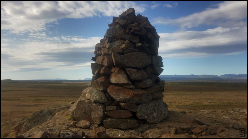
Many cairns dot the landscape in Iceland because many people place their burdens or problems in the rocks and them put them in a pile like this one. How often do we let the burdens of our past keep us from progressing into the future?
It was really nice and relaxing at Fossatún. If we didn't have a schedule to keep, I would have stayed here for the night.
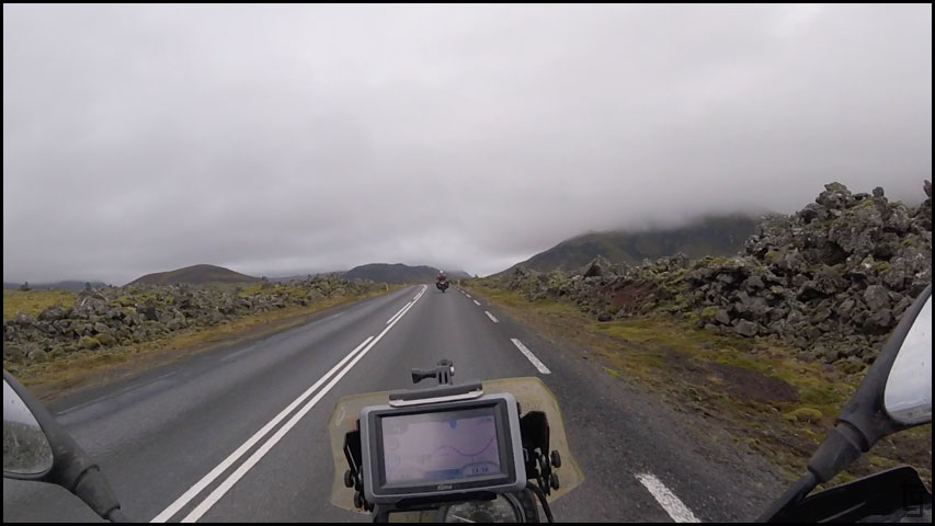
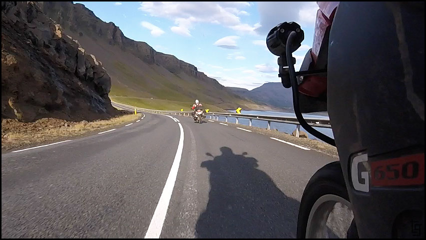
We continued south-west making our way to Reykjavik via the 1 but bypassed the tolled (not trolled, that's for bridges) tunnel to enjoy the ride around Hvalfjörður via the 47. This was some of my favorite pavement riding of the trip; beautiful views, twisty mountain roads, and minimal car traffic. Apparently other two-wheeled riders felt the same way because we saw more motorcycles on the 47 than we've seen the whole trip so far.
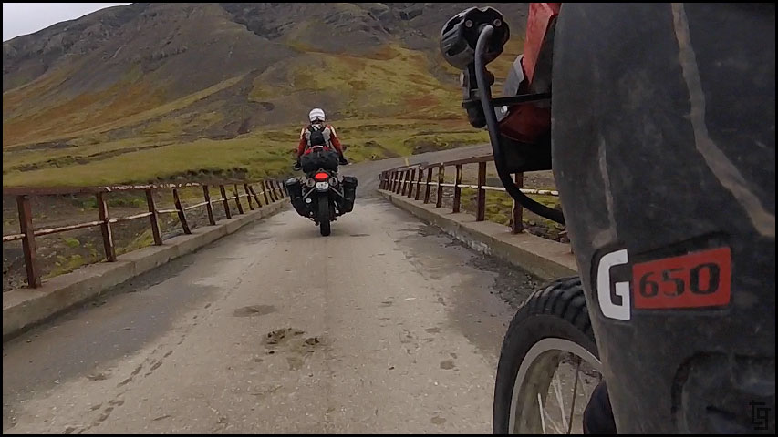
Crossing a single lane bridge on the 47.
Some of the best road riding of the trip so far.
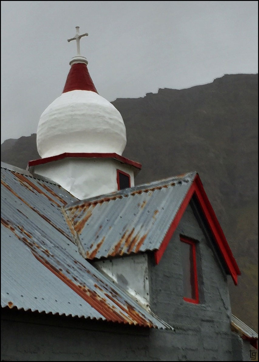
One of the many churches that dot the landscape in Iceland. Many of them are the centerpiece of the town.
Caught the lighting on this one where the shadow of the cross reflects right on the roof.
Sunny, warm, and a perfect day for riding uncrowded roads with great scenery.
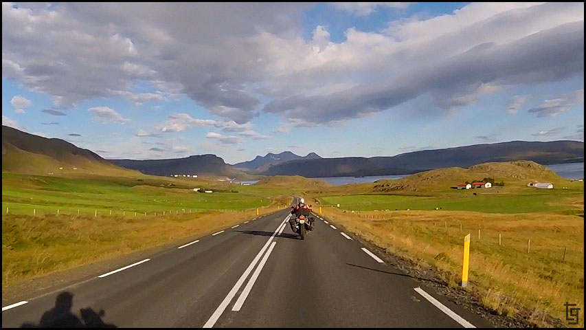
Beautiful!! This feeling should be able to be bottled so it can be shared with others.
Arriving in Reykjavik was a bit crazy with people and traffic all racing around. We managed the maze of congested roads and arrived at Hallgrimskirkja church without getting lost or going against the myriad of one-way roads. We seemed to have timed our arrival perfect because I was able to take some great pictures of the church with the late evening lighting.
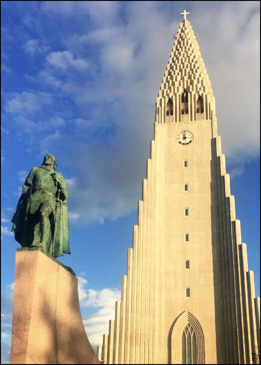
No church in Iceland has the presence of the Hallgrimskirkja.
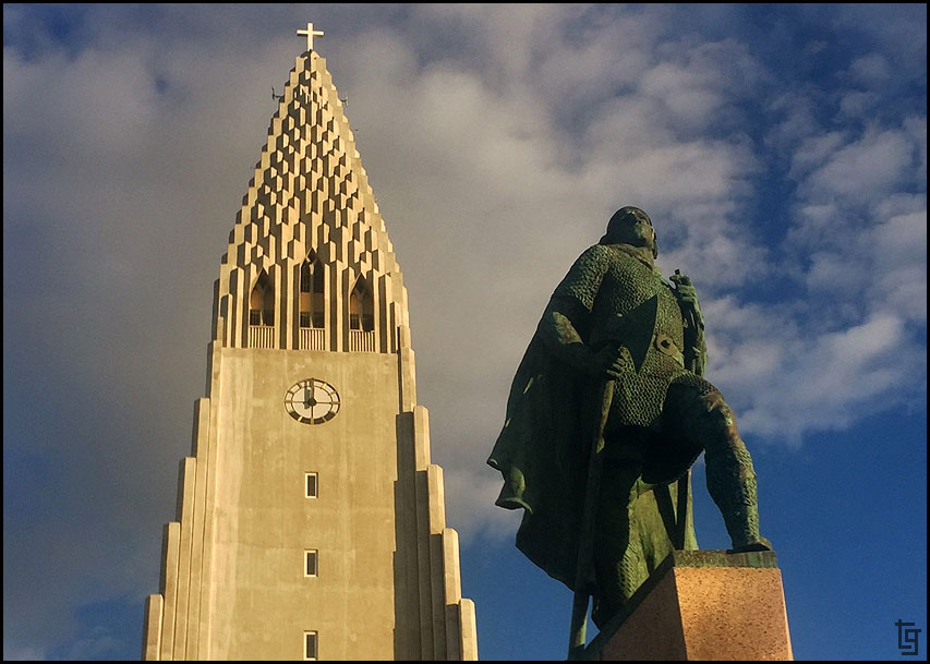
The statue of explorer Leif Eriksson stands proudly at the front of the Hallgrimskirkja.
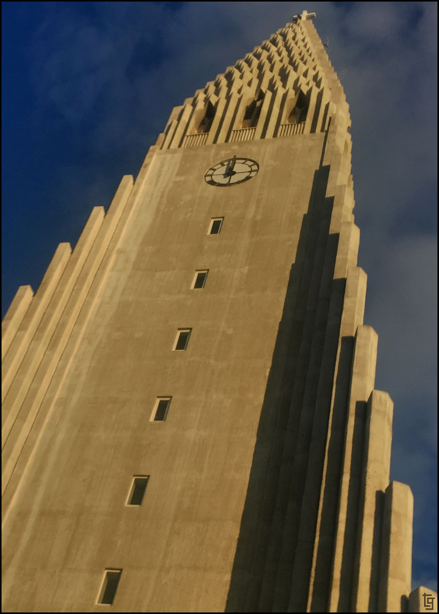
At 74.5 metres (244 ft) high, it is the largest church in Iceland.
Since it was going to be dark soon, we pressed on to dinner at, of all places, Kentucky Fried Chicken. After another 30 minutes we stopped in Sandgerði where we camped for the night.
Day 10: Tue, 29 Aug 17:Map of Day 10
We got an early start, partly because we were camped just off the road and didn't want to arouse any more suspicion, and partly because we were excited for another day without rain.
Our first stop was Deildartunguhver hot springs but they were under a lot of construction making it difficult to see the boiling water coming from the depths of the Earth. The steam, on the other hand, was noticeable for miles around.
Hot stuff - in various languages.
As the morning progressed we realized that we were definitely within hours of the capital of Raykavik because the roads and tourist attractions were full of rentals and tour buses.
Our next stop of Barnafoss falls was not the most beautiful of Icelands falls but it did have a nice hike.
We wanted to explore a lava cave but many of them have become "touristized" and require a steep fee to have a guide walk you though. Not my thing; I'd rather explore at my own pace. Fortunately, for those adventurous enough there is Surtshellir cave. We parked well north of the parking area and walked south underground exploring each of the caves and entrances. The caves really are quite large some featured beautiful metallic looking stalactites.
Heading to the Surtshellir cave via a well traveled dirt road.
On our walk to the Surtshellir cave you see huge cube shaped rocks that were pushed upwards along the fault line.
The power of Mother Earth!
One of the cave entrances.
Inside it was cold and damp; kinda like you expect a cave to be. Once you were in the cave about 100 yards it was completely black.
This black. No kidding. Black so black you can't see anything. Not having a lamp would be death by a thousand tiny volcanic rock cuts.
Leaving in search of other sites...
On out way back from the caves we came across Fossatún Falls. This is a really relaxing area with a great walking trail that taught about trolls and the Icelandic folklore that surrounding them.
Tröllafossar or the Fall of the Trolls
The trail has many displays with the artwork from Steinar Berg who has written three books on trolls and has erected several trolls from his stories.
Troll head
This is Grýla, who is the mother of the Yulelads. She is not the nicest of the trolls because she eats naughty children and cooks them in her cauldron.
Maybe she's not so bad because she only cooks the naughty children
Many cairns dot the landscape in Iceland because many people place their burdens or problems in the rocks and them put them in a pile like this one. How often do we let the burdens of our past keep us from progressing into the future?
It was really nice and relaxing at Fossatún. If we didn't have a schedule to keep, I would have stayed here for the night.
We continued south-west making our way to Reykjavik via the 1 but bypassed the tolled (not trolled, that's for bridges) tunnel to enjoy the ride around Hvalfjörður via the 47. This was some of my favorite pavement riding of the trip; beautiful views, twisty mountain roads, and minimal car traffic. Apparently other two-wheeled riders felt the same way because we saw more motorcycles on the 47 than we've seen the whole trip so far.
Crossing a single lane bridge on the 47.
Some of the best road riding of the trip so far.
One of the many churches that dot the landscape in Iceland. Many of them are the centerpiece of the town.
Caught the lighting on this one where the shadow of the cross reflects right on the roof.
Sunny, warm, and a perfect day for riding uncrowded roads with great scenery.
Beautiful!! This feeling should be able to be bottled so it can be shared with others.
Arriving in Reykjavik was a bit crazy with people and traffic all racing around. We managed the maze of congested roads and arrived at Hallgrimskirkja church without getting lost or going against the myriad of one-way roads. We seemed to have timed our arrival perfect because I was able to take some great pictures of the church with the late evening lighting.
No church in Iceland has the presence of the Hallgrimskirkja.
The statue of explorer Leif Eriksson stands proudly at the front of the Hallgrimskirkja.
At 74.5 metres (244 ft) high, it is the largest church in Iceland.
Since it was going to be dark soon, we pressed on to dinner at, of all places, Kentucky Fried Chicken. After another 30 minutes we stopped in Sandgerði where we camped for the night.
